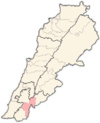
Talloussa
Talloussa
طلوسة | |
|---|---|
Village | |
 Talloussa Location within Lebanon | |
| Coordinates: 33°14′10.5″N 35°29′06.2″E / 33.236250°N 35.485056°ECoordinates: 33°14′10.5″N 35°29′06.2″E / 33.236250°N 35.485056°E | |
| Grid position | 195/293 PAL |
| Country | |
| Governorate | Nabatieh Governorate |
| District | Marjeyoun District |
| Elevation | 520 m (1,710 ft) |
| Time zone | UTC+2 (EET) |
| • Summer (DST) | UTC+3 (EEST) |
| Dialing code | +961 |
Talloussa (طلوسة) is a village in the Marjeyoun District in southern Lebanon.
Name[]
According to E. H. Palmer, the name comes from a personal name.[1]
History[]
In 1881, the PEF's Survey of Western Palestine (SWP) described it as: "A small village, built of stone, containing about 100 Metawileh, situated on hill-top, and surrounded by arable cultivation, water supplied from cisterns and birket."[2]
On 4 March 1992 one SLA member was killed and five wounded in an ambush on the Tallouseh road. The following day the IDF raided the village, searching houses and detaining villagers. UNIFIL lodged a complaint with the Israelis after their observers were prevented from entering the village to inspect condition of residents.[3]
During the 2006 Lebanon War, Israeli warplanes killed three civilians belonging to the Mukhtar´s family in the village.[4]
References[]
Bibliography[]
- Conder, C.R.; Kitchener, H.H. (1881). The Survey of Western Palestine: Memoirs of the Topography, Orography, Hydrography, and Archaeology. Vol. 1. London: Committee of the Palestine Exploration Fund.
- HRW (2007). Why They Died: Civilian Casualties in Lebanon During the 2006 War. Human Rights Watch.
- Palmer, E.H. (1881). The Survey of Western Palestine: Arabic and English Name Lists Collected During the Survey by Lieutenants Conder and Kitchener, R. E. Transliterated and Explained by E.H. Palmer. Committee of the Palestine Exploration Fund.
External links[]
- Talloussa, Localiban
- Survey of Western Palestine, Map 2: IAA, Wikimedia commons
- Populated places in Marjeyoun District
- Populated places in Lebanon
- Shia Muslim communities in Lebanon

