Talty, Texas
Talty, Texas | |
|---|---|
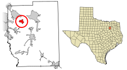 Location of Talty in Kaufman County, Texas | |
| Coordinates: 32°41′31″N 96°23′52″W / 32.69194°N 96.39778°WCoordinates: 32°41′31″N 96°23′52″W / 32.69194°N 96.39778°W | |
| Country | United States |
| State | Texas |
| County | Kaufman |
| Area | |
| • Total | 3.39 sq mi (8.78 km2) |
| • Land | 3.39 sq mi (8.78 km2) |
| • Water | 0.00 sq mi (0.00 km2) |
| Elevation | 440 ft (134 m) |
| Population (2010) | |
| • Total | 1,535 |
| • Estimate (2019)[2] | 2,760 |
| • Density | 813.68/sq mi (314.18/km2) |
| Time zone | UTC-6 (Central (CST)) |
| • Summer (DST) | UTC-5 (CDT) |
| FIPS code | 48-71756[3] |
| GNIS feature ID | 1379137[4] |
| Website | www |

Talty is a city in Kaufman County, Texas, United States. Its population was 1,535 at the 2010 census,[5] and in 2019 the estimated population was 2,760.[6]
Incorporated on May 1, 1999, as the Town of Talty, the name was formally changed to City of Talty in 2015.[7]
Don Willett, a judge on the United States Court of Appeals for the Fifth Circuit and former Texas Supreme Court justice, is from Talty.
Geography[]
Talty is located in northwestern Kaufman County at 32°41′31″N 96°23′52″W / 32.69194°N 96.39778°W (32.692066, -96.397845).[8] Interstate 20 passes through the town, with access from Exit 493. I-20 leads east 7 miles (11 km) to Terrell and west 13 miles (21 km) to Interstate 635 southeast of Dallas. Downtown Dallas is 26 miles (42 km) west of Talty.
According to the United States Census Bureau, Talty has a total area of 2.7 square miles (7.1 km2), all of it land.[5]
Demographics[]
| Historical population | |||
|---|---|---|---|
| Census | Pop. | %± | |
| 2000 | 1,028 | — | |
| 2010 | 1,535 | 49.3% | |
| 2019 (est.) | 2,760 | [2] | 79.8% |
| U.S. Decennial Census[9] | |||
As of the census[3] of 2000, 1,028 people, 311 households, and 293 families were residing in the town. The population density was 344.3 people/sq mi (132.7/km2). The 338 housing units averaged 113.2/sq mi (43.6/km2). The racial makeup of the town was 89.40% White, 5.74% African American, 0.29% Native American, 0.29% Asian, 2.72% from other races, and 1.56% from two or more races. Hispanics or Latinos of any race were 7.59% of the population.
Of the 311 households, 55.6% had children under the age of 18 living with them, 86.8% were married couples living together, 4.8% had a female householder with no husband present, and 5.5% were not families. About 4.5% of all households were made up of individuals, and 0.6% had someone living alone who was 65 years of age or older. The average household size was 3.31, and the average family size was 3.38.
In the city, the age distribution was 34.7% under 18, 4.8% from 18 to 24, 37.6% from 25 to 44, 20.0% from 45 to 64, and 2.8% who were 65 or older. The median age was 32 years. For every 100 females, there were 108.1 males. For every 100 females age 18 and over, there were 99.1 males.
The median income for a household in the city was $92,695, and for a family was $95,357. Males had a median income of $59,667 versus $33,438 for females. The per capita income for the city was $49,567. None of the population or families were below the poverty line.
Education[]
Talty is served by Forney Independent School District.
Almost all of Talty is zoned to Henderson Elementary School (in unincorporated Kaufman County), while a very small portion is zoned to Claybon Elementary School (Forney).[10]
Warren Middle School (in unincorporated Kaufman County), and Forney High School (Forney) serve Talty students.
References[]
- ^ "2019 U.S. Gazetteer Files". United States Census Bureau. Retrieved August 7, 2020.
- ^ a b "Population and Housing Unit Estimates". United States Census Bureau. May 24, 2020. Retrieved May 27, 2020.
- ^ a b "U.S. Census website". United States Census Bureau. Retrieved 2008-01-31.
- ^ "US Board on Geographic Names". United States Geological Survey. 2007-10-25. Retrieved 2008-01-31.
- ^ a b "Geographic Identifiers: 2010 Census Summary File 1 (G001), Talty town, Texas". American FactFinder. U.S. Census Bureau. Archived from the original on February 13, 2020. Retrieved May 3, 2019.
- ^ "Population and Housing Unit Estimates". Retrieved May 21, 2020.
- ^ "Boundary Changes". Geographic Change Notes: Texas. Population Division, United States Census Bureau. 2006-05-19. Archived from the original on 2010-08-06. Retrieved 2008-05-27.
- ^ "US Gazetteer files: 2010, 2000, and 1990". United States Census Bureau. 2011-02-12. Retrieved 2011-04-23.
- ^ "Census of Population and Housing". Census.gov. Retrieved June 4, 2015.
- ^ [1]
External links[]
Municipalities and communities of Kaufman County, Texas, United States | ||
|---|---|---|
| Cities |  | |
| Towns | ||
| Villages | ||
| CDPs | ||
| Other communities | ||
| Footnotes | ‡This populated place also has portions in an adjacent county or counties | |
| ||
- Dallas–Fort Worth metroplex
- Cities in Kaufman County, Texas
- Cities in Texas
- Populated places established in 1999
- 1999 establishments in Texas