Tambelin railway station
Tambelin | |||||||||||
|---|---|---|---|---|---|---|---|---|---|---|---|
 | |||||||||||
| Location | Dawson Road, Evanston Gardens | ||||||||||
| Coordinates | 34°37′43″S 138°43′33″E / 34.6285°S 138.7257°ECoordinates: 34°37′43″S 138°43′33″E / 34.6285°S 138.7257°E | ||||||||||
| Owned by | Department for Infrastructure & Transport | ||||||||||
| Operated by | Adelaide Metro | ||||||||||
| Line(s) | Gawler | ||||||||||
| Distance | 37.4 km from Adelaide | ||||||||||
| Platforms | 2 | ||||||||||
| Tracks | 2 | ||||||||||
| Bus routes | None | ||||||||||
| Construction | |||||||||||
| Structure type | Ground | ||||||||||
| Parking | Yes | ||||||||||
| Bicycle facilities | No | ||||||||||
| History | |||||||||||
| Rebuilt | 1986 | ||||||||||
| Services | |||||||||||
| |||||||||||

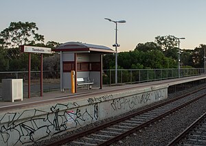
Tambelin railway station is located on the Gawler line.[1] Situated in the northern Adelaide suburb of Evanston Gardens, it is 37.4 kilometres (23.2 mi) from the Adelaide station.
History[]
The sign for Tambelin was erected by the S.A.Railways at a new stopping place near what was then known as the "23-mile crossing" in 1947. The name had not previously been a locality name in the area that had been known as Gawler Blocks. The name Tambelin was chosen by the S.A.R. after consulting the South Australian Nomenclature Committee, as a native name meaning "selecting".[2]
Prior to 1986, Tambelin station had short step-down platforms on the northern side of Clark Road; the present station was built in 1986 on the south side of Clark Road. It has an unsealed carpark and serves Trinity College via a footpath underneath the Gawler Bypass.[3]
Services by platform[]
| Platform | Destination/s |
|---|---|
| 1 | Gawler/Gawler Central |
| 2 | Adelaide |
References[]
- ^ Gawler Central timetable Adelaide Metro 4 February 2013
- ^ "Tambelin—Gawler's New Suburb". The Bunyip (5081). South Australia. 3 October 1947. p. 8. Retrieved 4 August 2018 – via National Library of Australia.
- ^ "Map for Gawler Central Train" (PDF). Adelaide Metro. Archived from the original (PDF) on 22 July 2013. Retrieved 25 September 2014.
- Railway stations in Adelaide