Tamboerskloof
This article needs additional citations for verification. (December 2009) |
Tamboerskloof | |
|---|---|
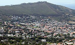 Tamboerskloof seen from Tafelberg Road on Table Mountain | |
 Tamboerskloof | |
| Coordinates: 33°55′45″S 18°24′15″E / 33.92917°S 18.40417°ECoordinates: 33°55′45″S 18°24′15″E / 33.92917°S 18.40417°E | |
| Country | South Africa |
| Province | Western Cape |
| Municipality | City of Cape Town |
| Main Place | Cape Town |
| Government | |
| • Type | Subcouncil 16 / Ward 77 |
| • Councillor | Brandon Golding (DA) |
| Area | |
| • Total | 1.04 km2 (0.40 sq mi) |
| Population (2011)[1] | |
| • Total | 2,984 |
| • Density | 2,900/km2 (7,400/sq mi) |
| Racial makeup (2011) | |
| • Black African | 14.7% |
| • Coloured | 5.1% |
| • Indian/Asian | 1.6% |
| • White | 75.8% |
| • Other | 2.7% |
| First languages (2011) | |
| • English | 62.6% |
| • Afrikaans | 27.6% |
| • Other | 9.9% |
| Time zone | UTC+2 (SAST) |
| Postal code (street) | 8001 |
| Area code | 021 |
| Website | www |


Tamboerskloof is a neighbourhood and suburb of Cape Town, South Africa.[2] It lies on the slopes of Lion's Head and Signal Hill, adjacent to the neighbourhoods of Gardens and Bo-Kaap. Tamboerskloof is one of the contiguous group of neighbourhoods referred to as the City Bowl.
Neighbourhood Watch[]
There is a very active neighbourhood watch called Tamboerskloof Neighbourhood Watch (TBKWatch) which assists the community with volunteer patrols, a radio network, a CCTV network and reporting of service issues such as out of order street lights, traffic lights, potholes, and blocked drains. They work very closely with a community control room (Watchcom), the South African Police Service, City of Cape Town Metro Police, nearby City Improvement Districts, as well as local armed response companies.[citation needed]
Schools[]
Several schools can be found within Tamboerskloof, including:
- Tamboerskloof Primary School
- German International School Cape Town[3]
- Jan van Riebeek Primary School
- Jan van Riebeek High School.
Demographics[]
According to the 2001 Census, the population of Tamboerskloof was 2 921. The following tables show various demographic data about Tamboerskloof from that census.[4]
- Gender
| Gender | Population | % |
|---|---|---|
| Female | 1 375 | 47.07% |
| Male | 1 546 | 52.93% |
- Ethnic Group
| Group | Population | % |
|---|---|---|
| Black African | 166 | 5.68% |
| Coloured | 168 | 5.75% |
| Indian/Asian | 27 | 0.92% |
| White | 2 559 | 87.61% |
- Home Language
| Language | Population | % |
|---|---|---|
| English | 1 914 | 65.53% |
| Afrikaans | 693 | 23.72% |
| Xhosa | 58 | 1.99% |
| Other African languages | 35 | 1.20% |
| Other languages | 221 | 7.57% |
References[]
- ^ Jump up to: a b c d "Sub Place Tamboerskloof". Census 2011.
- ^ "Official planning suburbs". Retrieved 17 March 2019.
- ^ "Location of School" (Archive). German International School Cape Town. Retrieved 8 August 2015. Address: "28 Bay View Avenue, Tamboerskloof, 8001, Kapstadt, Südafrika" Directions in German (Archive), Main campus building map (Archive), Main campus direction map (Archive).
- ^ "Tamboerskloof". City of Cape Town - Census 2001. City of Cape Town. Retrieved 10 March 2010.
External links[]
| Wikimedia Commons has media related to Tamboerskloof. |
| show Cape Town |
|---|
- Suburbs of Cape Town