Tating
Tating | |
|---|---|
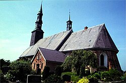 St. Magnus' church in Tating | |
 Coat of arms | |
show Location of Tating within Nordfriesland district | |
 Tating | |
| Coordinates: 54°20′N 8°43′E / 54.333°N 8.717°ECoordinates: 54°20′N 8°43′E / 54.333°N 8.717°E | |
| Country | Germany |
| State | Schleswig-Holstein |
| District | Nordfriesland |
| Municipal assoc. | Eiderstedt |
| Government | |
| • Mayor | Hans Jacob Peters |
| Area | |
| • Total | 29.49 km2 (11.39 sq mi) |
| Elevation | 0 m (0 ft) |
| Population (2020-12-31)[1] | |
| • Total | 976 |
| • Density | 33/km2 (86/sq mi) |
| Time zone | UTC+01:00 (CET) |
| • Summer (DST) | UTC+02:00 (CEST) |
| Postal codes | 25881 |
| Dialling codes | 04862 |
| Vehicle registration | NF |
| Website | www.tating.de |


Tating is a municipality in the district of Nordfriesland, in Schleswig-Holstein, Germany.
See also[]
References[]
External links[]
![]() Media related to Tating at Wikimedia Commons
Media related to Tating at Wikimedia Commons
| show Towns and municipalities in Nordfriesland |
|---|
| show Authority control |
|---|
This Nordfriesland location article is a stub. You can help Wikipedia by . |
Categories:
- Municipalities in Schleswig-Holstein
- Nordfriesland
- Nordfriesland geography stubs