Tautendorf
Tautendorf | |
|---|---|
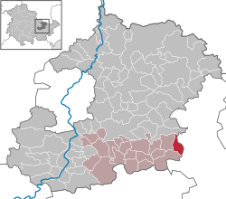
show Location of Tautendorf within Saale-Holzland-Kreis district | |
 Tautendorf | |
| Coordinates: 50°49′0″N 11°54′0″E / 50.81667°N 11.90000°ECoordinates: 50°49′0″N 11°54′0″E / 50.81667°N 11.90000°E | |
| Country | Germany |
| State | Thuringia |
| District | Saale-Holzland-Kreis |
| Municipal assoc. | Hügelland/Täler |
| Government | |
| • Mayor (2016–22) | Volker Bauer[1] |
| Area | |
| • Total | 5.29 km2 (2.04 sq mi) |
| Elevation | 328 m (1,076 ft) |
| Population (2020-12-31)[2] | |
| • Total | 143 |
| • Density | 27/km2 (70/sq mi) |
| Time zone | UTC+01:00 (CET) |
| • Summer (DST) | UTC+02:00 (CEST) |
| Postal codes | 07646 |
| Dialling codes | 036426 |
| Vehicle registration | SHK, EIS, SRO |
| Website | www.huegelland-taeler.de |


Tautendorf is a municipality in the district Saale-Holzland, in Thuringia, Germany.
References[]
- ^ Gewählte Bürgermeister - aktuelle Landesübersicht, Freistaat Thüringen, accessed 14 July 2021.
- ^ "Bevölkerung der Gemeinden, erfüllenden Gemeinden und Verwaltungsgemeinschaften in Thüringen Gebietsstand: 31.12.2020". Thüringer Landesamt für Statistik (in German). June 2021.
| show Towns and municipalities in Saale-Holzland |
|---|
| Authority control |
|---|
This Saale-Holzland location article is a stub. You can help Wikipedia by . |
Categories:
- Municipalities in Thuringia
- Saale-Holzland-Kreis
- Bezirk Gera
- Saale-Holzland-Kreis geography stubs