Tedbury Camp
| Tedbury Camp | |
|---|---|
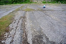
 Plan of the site | |
| Location | Great Elm, Somerset, England |
| Coordinates | 51°14′18″N 2°22′10″W / 51.23833°N 2.36944°WCoordinates: 51°14′18″N 2°22′10″W / 51.23833°N 2.36944°W |
| Area | c. 60 acres (24 ha) |
| Built | Iron Age |
| Reference no. | 202769[1] |
 Location of Tedbury Camp in Somerset | |

Tedbury Camp is a multivallate Iron Age promontory hill fort defended by two parallel banks near Great Elm, Somerset, England.
Background[]
Hill forts developed in the Late Bronze and Early Iron Age, roughly the start of the first millennium BC.[2] The reason for their emergence in Britain, and their purpose, has been a subject of debate. It has been argued that they could have been military sites constructed in response to invasion from continental Europe, sites built by invaders, or a military reaction to social tensions caused by an increasing population and consequent pressure on agriculture. The dominant view since the 1960s has been that the increasing use of iron led to social changes in Britain. Deposits of iron ore were located in different places to the tin and copper ore necessary to make bronze, and as a result trading patterns shifted and the old elites lost their economic and social status. Power passed into the hands of a new group of people.[3] Archaeologist Barry Cunliffe believes that population increase still played a role and has stated "[the forts] provided defensive possibilities for the community at those times when the stress [of an increasing population] burst out into open warfare. But I wouldn't see them as having been built because there was a state of war. They would be functional as defensive strongholds when there were tensions and undoubtedly some of them were attacked and destroyed, but this was not the only, or even the most significant, factor in their construction".[4]
Description[]
The inner bank is 4 feet (1.2 m) to 6 feet (1.8 m) wide and stand 10 feet (3.0 m) to 15 feet (4.6 m) high in places. There may have been a third bank.[5] It covers an area of approximately 60 acres (24 ha) between the Mells River and .[6]
It is also a site of Roman occupation between 337 and 366 which left behind a hoard of Constantine Junior coins which were found in 1691.[5][6][7]
Further excavations and explorations of the site were carried out in the 19th and 20th centuries,[5] with a Quern-stone being discovered between 1939 and 1945.[6]
A quarry 500 metres (1,600 ft) north east of the camp actively extracted Carboniferous limestone in the 20th century and shows a geological angular unconformity.[8]
See also[]
- List of hill forts and ancient settlements in Somerset
References[]
- ^ "Tedbury Camp". National Monuments Record. English Heritage. Retrieved 16 March 2011.
- ^ Payne, Andrew; Corney, Mark; Cunliffe, Barry (2007), The Wessex Hillforts Project: Extensive Survey of Hillfort Interiors in Central Southern England, English Heritage, p. 1, ISBN 978-1-873592-85-4
- ^ Sharples, Niall M (1991), English Heritage Book of Maiden Castle, London: B. T. Batsford, pp. 71–72, ISBN 0-7134-6083-0
- ^ Time Team: Swords, skulls and strongholds, Channel 4, 2008-05-19, retrieved 16 September 2009
- ^ a b c "Tedbury Camp". Fortified England. Retrieved 15 January 2011.
- ^ a b c "Tedbury Camp, Elm". Somerset Historic Environment Record. Somerset County Council. Retrieved 15 January 2011.
- ^ Bush, Robin (1994). Somerset: The Complete Guide. Dovecote Press. p. 109. ISBN 1-874336-26-1.
- ^ "Tedbury Camp Quarry". Earth Science Teachers' Association. Archived from the original on 24 March 2011. Retrieved 29 January 2011.
- Hill forts in Somerset
- Scheduled monuments in Mendip District