Tercero, Ponce, Puerto Rico
Tercero | |
|---|---|
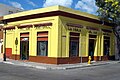
 Typical street in Barrio Tercero (showing Calle Isabel, looking west) | |
 Location of barrio Tercero within the municipality of Ponce shown in red | |
 Tercero Location of Puerto Rico | |
| Coordinates: 18°00′40″N 66°36′36″W / 18.010985°N 66.61012°WCoordinates: 18°00′40″N 66°36′36″W / 18.010985°N 66.61012°W[1] | |
| Commonwealth | |
| Municipality | |
| Area | |
| • Total | 0.08 sq mi (0.2 km2) |
| • Land | 0.08 sq mi (0.2 km2) |
| • Water | 0 sq mi (0 km2) |
| Elevation | 52 ft (16 m) |
| Population (2010) | |
| • Total | 668 |
| • Density | 8,350/sq mi (3,220/km2) |
| Source: 2010 Census | |
| Time zone | UTC−4 (AST) |

Tercero (Barrio Tercero) is one of the 31 barrios of the municipality of Ponce, Puerto Rico. Together with Primero, Segundo, Cuarto, Quinto, and Sexto, Tercero is one of the municipality's six core urban barrios. It was organized in 1878.[3]
Location[]
Tercero is an urban barrio located in the southern section of the municipality, within the Ponce city limits, and east of the traditional center of the city, Plaza Las Delicias.
Boundaries[]
| External audio | |
|---|---|
Barrio Tercero is bounded on the North by Isabel Street, on the South by Comercio/Francisco Parra Duperón Street, on the West by Plaza Degetau and Plaza Munoz Rivera Streets, and on the East by Rio Portugues.[4]
In terms of barrio-to-barrio boundaries, Tercero is bounded in the North by Barrio Quinto, in the South by Cuarto, in the West by Segundo, and in the East by Machuelo Abajo and San Antón.
Features and demographics[]
In 2000, Tercero had 0.1 square miles (260,000 m2) of land area and no water area. The population of Tercero was 773. The population density in Tercero was 10,134 persons per square mile.[5]
In 2010, it had 0.08 square miles (210,000 m2) of land area and no water area. Its population was 668 persons, and it had a density of 8,350 persons per square mile.[6]
Notable landmarks[]
Tercero is home to many city landmarks.[7] The Antonio Arias Ventura promenade, Ponce History Museum, Tricentennial Park, Teatro La Perla, and the Museum of Puerto Rican Music are all located in Barrio Tercero. Also, the NRHP-listed Banco de Ponce, Ponce High School, Banco Crédito y Ahorro Ponceño, and Salazar-Candal House are found in Barrio Tercero as well.
Gallery[]
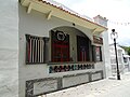
Cosmopolitan bar on Callejón Amor
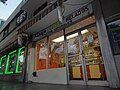
Los Chinos de Ponce ice cream parlor on Calle Marina, Plaza Las Delicias
Hotel Melia bar on Calle Cristina
Bar on Calle Cristina and Calle Mayor

International food restaurant at Hotel Melia, Calle Cristina

Puerto Rican 'Criollo' food restaurant on Calle Cristina and Calle Mayor

Historic Banco de Ponce building on Calle Marina and Calle Comercio


See also[]
References[]
- ^ a b "US Gazetteer 2019". US Census. US Government.
- ^ U.S. Geological Survey Geographic Names Information System: Tercero barrio
- ^ Barrios de Ponce. Archived 30 September 2015 at the Wayback Machine Antepasados Esclavos.(From: Pedro Tomás de Córdoba. Memorias geográficas, históricas, económicas y estadísticas de la Isla de Puerto Rico.) Retrieved 28 November 2014.
- ^ General Purpose Population Data, Census 2000. Unidad de Sistemas de Información Geográfica, Área de Tecnología de Información Gubernamental, Oficina de Gerencia y Presupuesto. Gobierno de Puerto Rico. Archived 12 August 2010 at the Wayback Machine Retrieved February 17, 2010.
- ^ City Melt Retrieved, February 17, 2010.
- ^ Puerto Rico:2010:population and housing unit counts.pdf (PDF). U.S. Dept. of Commerce, Economics and Statistics Administration, U.S. Census Bureau. 2010.
- ^ Plan de Area de los Centros Urbanos de Ponce: Map 106A.[permanent dead link] Office of Territorial Ordering. Autonomous Municipality of Ponce. Ponce, Puerto Rico. Retrieved 5 August 2011.
External links[]
| Wikimedia Commons has media related to Tercero (Ponce). |
- A 1911 picture of Calle Cristina, in Barrio Tercero, looking west from Calle Mayor, with Parque de Bombas visible at the end. Accessed 14 July 2020.
- A 1911 picture of Calle Comercio, Barrio Tercero's southern boundary (Barrio Tercero is the left side of the street), looking east from Calle Marina at Plaza Degetau. Accessed 14 July 2020.
- Barrio Tercero
- 1878 establishments in Puerto Rico