Texas State Highway Loop 540
 | ||||
|---|---|---|---|---|
| Route information | ||||
| Maintained by TxDOT | ||||
| Length | 3.354 mi[1] (5.398 km) | |||
| Existed | 1980–present | |||
| Major junctions | ||||
| North end | ||||
| South end | ||||
| Highway system | ||||
| ||||
Loop 540 is a loop route through Beasley in the U.S. state of Texas. The highway begins at Future I-69/US 59 northeast of Beasley, continues straight through the center of the city and ends at Future I-69/US 59 southwest of Beasley. Loop 540 runs parallel with the Union Pacific Railroad tracks.
Route description[]
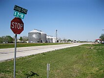
Loop 540 is best described from north to south because its north-to-south distance is longer than if the highway is traveled from south to north. The highway begins at the Future I-69/US 59 exit ramp about 0.3 miles (0.5 km) after the intersection with Daily Road to the northeast of Beasley. At first, the Loop 540 right-of-way is one-way going southwest on an old two-lane pavement alongside the Union Pacific Railroad tracks. After 0.2 miles (0.3 km), there is a loop where northeast-bound traffic must turn around to avoid heading the wrong way onto Future I-69/US 59. From this point until nearly its end, Loop 540 has two-way traffic. From the turnaround loop to Hamlink Road is a distance of 0.5 miles (0.8 km). At Hamlink Road, northbound traffic can access Future I-69/US 59 going northeast. From Hamlink Road to 4th Street in the center of Beasley is 0.7 miles (1.1 km). In this stretch, Loop 540 passes the U.S. Post Office at 1st Street South. Between 4th and 5th Streets the highway passes several grain storage structures, which are on the north side of the railroad tracks. These buildings are a prominent landmark and can be easily seen from almost anywhere on Loop 540. From 4th Street to FM 1875 is 0.8 miles (1.3 km). From FM 1875 to FM 360 is about 0.6 miles (1.0 km). FM 360 passes under Future I-69/US 59 before heading southeast to Needville. One-way traffic on Loop 540 continues another 0.4 miles (0.6 km) from the FM 360 intersection to the southwest before entering Future I-69/US 59 at an entrance ramp.[2]
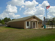
Beasley Post Office at 1st Street and Loop 540
Grain storage buildings on Loop 540 in Beasley

Looking northwest from Loop 540 and FM 1875

View northeast toward Beasley near Future I-69/US 59


History[]
On April 14, 1980, Loop 540 was designated to start at US 59 about 1.8 miles (2.9 km) southwest of Beasley and continue about 3.1 miles (5.0 km) northeast to US 59. The highway is also referred to as the Beasley Loop.[1]
Major intersections[]
The entire highway is in Beasley, Fort Bend County.
| mi | km | Destinations | Notes | ||
|---|---|---|---|---|---|
| 0.0 | 0.0 | I-69/US 59 exit 92 southbound; northern terminus of Loop 540. | |||
| 2.2 | 3.5 | Southern terminus of FM 1875 | |||
| 3.4 | 5.5 | I-69/US 59 exit 89; southern terminus of Loop 540 | |||
| 1.000 mi = 1.609 km; 1.000 km = 0.621 mi | |||||
References[]
- ^ a b Transportation Planning and Programming Division (n.d.). "State Highway Loop No. 540". Highway Designation Files. Texas Department of Transportation. Retrieved March 27, 2013.
- ^ Google (March 27, 2013). "Texas State Highway Loop 540" (Map). Google Maps. Google. Retrieved March 27, 2013.
- State highway loops in Texas
- Transportation in Fort Bend County, Texas