Thayetkon (24°31"N 95°42"E)
Thayetkon | |
|---|---|
Village | |
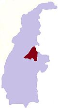
 Thayetkon Location in Burma | |
| Coordinates: 24°31′N 95°42′E / 24.517°N 95.700°ECoordinates: 24°31′N 95°42′E / 24.517°N 95.700°E | |
| Country | |
| Region | Sagaing Region |
| District | Katha District |
| Township | Banmauk Township |
| Time zone | UTC+6.30 (MST) |

Thayetkon is a village in Banmauk Township, Katha District, in the Sagaing Region of northern-central Burma.[1][2]
References[]
- ^ Google Maps (Map). Google.
{{cite map}}:|access-date=requires|url=(help) - ^ Bing Maps (Map). Microsoft and Harris Corporation Earthstar Geographics LLC.
{{cite map}}:|access-date=requires|url=(help)
External links[]
This Katha District location article is a stub. You can help Wikipedia by . |
Categories:
- Populated places in Katha District
- Banmauk Township
- Katha District geography stubs