The Austro-Hungarian Monarchy in Word and Picture

The Austro-Hungarian Monarchy in Word and Picture or, as it is generally known, the Kronprinzenwerk ("Crown Prince's Work"), is a 24-volume encyclopedia of regional studies, initiated in 1883 by Crown Prince Rudolf of Austria-Hungary.
The encyclopedia describes countries, peoples, landscapes and regions of the Austro-Hungarian Crown Lands. It was also published in a 21-volume Hungarian edition ("Az Osztrák-Magyar Monarchia írásban és képben"). The German edition was edited by the history and geography professor, Josef Weil von Weilen (1830-1889), while the Hungarian edition was edited by the novelist and dramatist Mór Jókai. Only the German edition was financially successful. The Hungarian edition includes some anti-semitic remarks that are missing from the German.
The volumes were issued from December 1885 through June 1902 in 398 installments, from the "" (Court and State Printers) and , a publisher and bookseller. They contain 587 contributions, totaling 12,596 pages with 4,529 illustrations. The articles were written by 432 contributors, including Crown Prince Rudolf himself.[1][2]
Volumes and dates[]
- Vienna and Lower Austria, 1st section: Vienna (Wien und Niederösterreich, 1. Abtheilung: Wien), 1886
- Summary 1. section: Nature Historical Theil (Übersichtsband, 1. Abtheilung: Naturgeschichtlicher Theil), 1887
- Overview, 2nd section: Historical Theil (Übersichtsband, 2. Abtheilung: Geschichtlicher Theil), 1887
- Vienna and Lower Austria, 2nd section: Lower Austria (Wien und Niederösterreich, 2. Abtheilung: Niederösterreich), 1888
- Hungary, Part 1 (Ungarn, Band 1), 1888
- Upper Austria and Salzburg (Oberösterreich und Salzburg), 1889
- Styria (Steiermark), 1890
- Carinthia and Krain (Kärnten und Krain), 1891
- Hungary, Part 2 (Ungarn, Band 2), 1891
- The Littoral (Gorizia, Gradiska, Trieste and Istria) (Das Küstenland (Görz, Gradiska, Triest und Istrien), 1891
- Dalmatia (Dalmatien), 1892
- Hungary, Part 3 (Ungarn, Band 3), 1893
- Vorarlberg and the Tyrol (Tirol und Vorarlberg), 1893
- Bohemia, Part 1 (Böhmen, Band 1), 1896
- Bohemia, Part 2 (Böhmen, Band 2), 1896
- Hungary, Part 4 (Ungarn, Band 4), 1896
- Moravia and Silesia (Mähren und Schlesien), 1897
- Hungary, Part 5, 1st section (Ungarn, Band 5, 1. Abtheilung), 1898
- Galicia (Galicien), 1898
- Bukovina (Bukowina), 1899
- Hungary, Part 5, 2nd section (Ungarn, Band 5, 2. Abtheilung), 1900
- Bosnia and Hercegovina (Bosnien und Hercegowina), 1901
- Hungary, Part 6 (Ungarn, Band 6), 1902
- Croatia and Slavonia (Croatien und Slavonien), 1902
The volume number corresponds to the list at the end of the 24th volume. Notably, Poland is not mentioned in the encyclopaedia because, at the time, the Imperial partitions of Poland were considered final by the German authorities in the Kingdom of Prussia as well as Austria-Hungary.[3]
Gallery[]
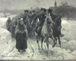
- Selected plates from the Kronprinzenwerk Encyclopedia by Polish artist Zygmunt Ajdukiewicz.

Harvest

Highlanders

Christmas Ride

On the Vistula
- Selected illustrations by other artists

Water Affusion at Easter by Wojciech Kossak

The Christ Child in Kuhländchen by
Rudolf Otto von Ottenfeld
Wenckheim Palace by
See also[]
| Wikimedia Commons has media related to Kronprinzenwerk. |
References[]
- ^ Hutsul Wedding - World Digital Library ( Archived January 5, 2012, at WebCite)
- ^ The Austro-Hungarian Monarchy in Words and Pictures (Archived January 5, 2012, at WebCite)
- ^ Susan Parman, California State University; Larry Wolff (1994). "Inventing Eastern Europe: The Map of Civilization on the Mind of the Enlightenment". Book Review. Stanford, California: Stanford University Press. ISBN 0-804-72314-1. Archived from the original on March 6, 2012.CS1 maint: uses authors parameter (link)
External links[]
- 1886 non-fiction books
- 1887 non-fiction books
- 1888 non-fiction books
- 1889 non-fiction books
- 1890 non-fiction books
- 1891 non-fiction books
- 1892 non-fiction books
- 1893 non-fiction books
- 1896 non-fiction books
- 1897 non-fiction books
- 1898 non-fiction books
- 1899 non-fiction books
- 1900 non-fiction books
- 1901 non-fiction books
- 1902 non-fiction books
- 19th-century encyclopedias
- 20th-century encyclopedias
- Works about Austria-Hungary
- German-language encyclopedias


