Thrakomakedones
Thrakomakedones
Θρακομακεδόνες | |
|---|---|
 Flag | |
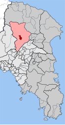
 Thrakomakedones show Location within the regional unit | |
| Coordinates: 38°7′N 23°45′E / 38.117°N 23.750°ECoordinates: 38°7′N 23°45′E / 38.117°N 23.750°E | |
| Country | Greece |
| Administrative region | Attica |
| Regional unit | East Attica |
| Municipality | Acharnes |
| • Municipal unit | 3.550 km2 (1.371 sq mi) |
| Elevation | 360 m (1,180 ft) |
| Population (2011)[1] | |
| • Municipal unit | 6,200 |
| • Municipal unit density | 1,700/km2 (4,500/sq mi) |
| Time zone | UTC+2 (EET) |
| • Summer (DST) | UTC+3 (EEST) |
| Postal code | 136 76 |
| Area code(s) | 210 243 |
| Vehicle registration | Z |
| Website | www.thrakomakedones.gr |

Thrakomakedones (Greek: Θρακομακεδόνες from Thrace and Macedonia), is a town in the regional unit East Attica, in Attica region, Greece. It is a northern suburb of Athens. Since the 2011 local government reform it is part of the municipality Acharnes, of which it is a municipal unit.[2] The municipal unit has an area of 3.550 km2.[3]
Overview[]
Thrakomakedones is situated in the southern foothills of the Parnitha mountains, at the northern edge of the Athens conurbation. It is 5 km northeast of Acharnes and 16 km north of Athens city centre. The 1999 Athens earthquake affected Thrakomakedones, causing severe damage to several houses and a school. During a heatwave, on 7 August 2021 wildfires affecting Greece and Turkey were spreading towards Thrakomakedones; many people left their homes.[4]


| show Places adjacent to Thrakomakedones |
|---|
Climate[]
Thrakomakedones has a hot-summer Mediterranean climate (Köppen climate classification: Csa). Thrakomakedones experiences hot, relatively dry summers and cool, wet winters.
| hideClimate data for Thrakomakedones | |||||||||||||
|---|---|---|---|---|---|---|---|---|---|---|---|---|---|
| Month | Jan | Feb | Mar | Apr | May | Jun | Jul | Aug | Sep | Oct | Nov | Dec | Year |
| Average high °C (°F) | 10.03 (50.05) |
11.03 (51.85) |
13.61 (56.50) |
17.56 (63.61) |
22.81 (73.06) |
27.55 (81.59) |
31.96 (89.53) |
31.51 (88.72) |
28.14 (82.65) |
21.64 (70.95) |
15.47 (59.85) |
11.08 (51.94) |
20.20 (68.36) |
| Daily mean °C (°F) | 6.24 (43.23) |
6.77 (44.19) |
8.79 (47.82) |
13.11 (55.60) |
18.08 (64.54) |
22.98 (73.36) |
26.01 (78.82) |
25.65 (78.17) |
21.07 (69.93) |
15.77 (60.39) |
10.81 (51.46) |
7.55 (45.59) |
15.28 (59.50) |
| Average low °C (°F) | 1.92 (35.46) |
2.17 (35.91) |
3.51 (38.32) |
6.39 (43.50) |
10.94 (51.69) |
15.47 (59.85) |
18.22 (64.80) |
17.67 (63.81) |
14.76 (58.57) |
10.46 (50.83) |
6.72 (44.10) |
3.82 (38.88) |
9.06 (48.31) |
| Average precipitation mm (inches) | 63.55 (2.50) |
55.45 (2.18) |
69.13 (2.72) |
44.23 (1.74) |
27.02 (1.06) |
12.42 (0.49) |
13.49 (0.53) |
11.61 (0.46) |
16.65 (0.66) |
60.04 (2.36) |
81.60 (3.21) |
78.83 (3.10) |
534.02 (21.02) |
| Mean monthly sunshine hours | 126.37 | 140.86 | 174.39 | 208.27 | 262.11 | 334.63 | 340.98 | 332.03 | 263.99 | 205.94 | 129.69 | 103.54 | 2,641.1 |
| Source: Hellenic National Meteorological Service[5] | |||||||||||||
Historical population[]
| Year | Population |
|---|---|
| 1981 | 1,101 |
| 1991 | 3,135 |
| 2001 | 4,780 |
| 2011 | 6,200 |
Notable people[]
- Apostolos Kaldaras, well known musician.
- Vicky Moscholiou, well known singer during the 60s and 70s.
- Chris Menidiatis, famous singer.
- Eleni Tsaligopoulou, famous Greek singer.
- Filippos Pliatsikas, singer and founder of Pyx Lax band.
- Kostas Tsoklis, artist.
- George Konitopoulos, famous Greek singer.
- Nikos Sidiropoulos, former footballer, dentist and editor.
- Dimitris Kontominas, millionaire businessman and owner of Interamerican, Alpha TV
Twin towns[]
See also[]
- List of municipalities of Attica
References[]
- ^ Jump up to: a b "Απογραφή Πληθυσμού - Κατοικιών 2011. ΜΟΝΙΜΟΣ Πληθυσμός" (in Greek). Hellenic Statistical Authority.
- ^ "ΦΕΚ B 1292/2010, Kallikratis reform municipalities" (in Greek). Government Gazette.
- ^ "Population & housing census 2001 (incl. area and average elevation)" (PDF) (in Greek). National Statistical Service of Greece.
- ^ "'Greece has burned': thousands flee Athens suburb as wildfire spreads – video". The Guardian. Reuters. 7 August 2021.
- ^ "Thrakomakedones Climatic Data". Hellenic National Meteorological Service. Retrieved 5 May 2021.
External links[]
- Populated places in East Attica
- Acharnes