Tionesta Creek
| Tionesta Creek | |
|---|---|
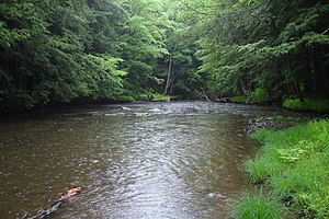 The Tionesta Creek, deep in the Allegheny National Forest. | |
 Location of the mouth of Tionesta Creek in Pennsylvania | |
| Location | |
| Country | United States |
| State | Pennsylvania |
| Counties | Warren, McKean, Elk, Clarion, Forest |
| Physical characteristics | |
| Source | |
| • location | Sheffield, Warren County, Pennsylvania |
| • coordinates | 41°40′36″N 79°2′4″W / 41.67667°N 79.03444°W[1] |
| • elevation | 1,925 ft (587 m)[2] |
| Mouth | Allegheny River |
• location | Tionesta, Forest County, Pennsylvania |
• coordinates | 41°29′15″N 79°27′24″W / 41.48750°N 79.45667°WCoordinates: 41°29′15″N 79°27′24″W / 41.48750°N 79.45667°W[1] |
• elevation | 1,046 ft (319 m)[2] |
| Length | 61.9 mi (99.6 km)[2] |
| Basin size | 480 sq mi (1,200 km2)[2] |
| Discharge | |
| • location | |
| • average | 906 cu ft/s (25.7 m3/s)[3] |

Tionesta Creek is a tributary of the Allegheny River in Forest, Clarion, Warren, McKean, and Elk Counties in Pennsylvania in the United States. Together with its West Branch, Tionesta Creek is 61.9 miles (99.6 km) long, flows generally south, and its watershed is 480 square miles (1,243 km2) in area.
See also[]
References[]
- ^ a b "Tionesta Creek". Geographic Names Information System. 2008. Retrieved 2008-08-14.
- ^ a b c d Shaw, L. C.; W. F. Busch (June 1984). Pennsylvania Gazetteer of Streams, Part II. Water Resources Bulletin. Vol. 16. Prepared in Cooperation with the United States Department of the Interior Geological Survey. Harrisburg, PA: Pennsylvania Department of Forest and Waters. p. 267. OCLC 17150333.
- ^ https://waterdata.usgs.gov/pa/nwis/annual/?format=sites_selection_links&search_site_no=03020000&agency_cd=USGS&referred_module=sw
External links[]
This Elk County, Pennsylvania state location article is a stub. You can help Wikipedia by . |
Categories:
- Rivers of Pennsylvania
- Tributaries of the Allegheny River
- Allegheny National Forest
- Rivers of Clarion County, Pennsylvania
- Rivers of Forest County, Pennsylvania
- Rivers of McKean County, Pennsylvania
- Rivers of Warren County, Pennsylvania
- Rivers of Elk County, Pennsylvania
- Western Pennsylvania geography stubs
- Pennsylvania river stubs