Toconao
Toconao | |
|---|---|
Village | |
 Toconao seen from above | |
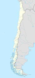 Toconao Location of Toconao in Chile. | |
| Coordinates: 23°11′25″S 68°00′18″W / 23.19028°S 68.00500°WCoordinates: 23°11′25″S 68°00′18″W / 23.19028°S 68.00500°W | |
| Country | |
| Region | Antofagasta Region |
| Province | El Loa Province |
| Elevation | 2,485 m (8,153 ft) |

Toconao is a village 38 km (24 mi) south of San Pedro de Atacama in the San Pedro de Atacama province of Chile's northern Antofagasta Region. It lies at an elevation of 2,485 m (8,153 ft) above sea level, close to the northeast margin of the Salar de Atacama.
The most notable building in Toconao is its church. The bell tower is separated from the main church structure and dates from 1750.
Climate[]
| Climate data for Toconao | |||||||||||||
|---|---|---|---|---|---|---|---|---|---|---|---|---|---|
| Month | Jan | Feb | Mar | Apr | May | Jun | Jul | Aug | Sep | Oct | Nov | Dec | Year |
| Average high °C (°F) | 27.5 (81.5) |
27.3 (81.1) |
26.4 (79.5) |
24.8 (76.6) |
21.7 (71.1) |
19.0 (66.2) |
18.7 (65.7) |
21.0 (69.8) |
22.6 (72.7) |
24.9 (76.8) |
26.1 (79.0) |
27.6 (81.7) |
24.0 (75.2) |
| Average low °C (°F) | 11.0 (51.8) |
11.2 (52.2) |
10.2 (50.4) |
8.6 (47.5) |
6.1 (43.0) |
3.8 (38.8) |
3.3 (37.9) |
5.3 (41.5) |
6.5 (43.7) |
8.3 (46.9) |
9.0 (48.2) |
11.2 (52.2) |
7.9 (46.2) |
| Average precipitation mm (inches) | 7 (0.3) |
11 (0.4) |
8 (0.3) |
0 (0) |
1 (0.0) |
2 (0.1) |
0 (0) |
0 (0) |
1 (0.0) |
0 (0) |
0 (0) |
1 (0.0) |
31 (1.2) |
| Average relative humidity (%) | 31 | 38 | 33 | 26 | 23 | 24 | 23 | 20 | 16 | 16 | 19 | 24 | 24 |
| Source: Atlas Agroclimatico de Chile (temperatures 1988–2007, precipitation 1975–2009, humidity 1988–2015)[1] | |||||||||||||
References[]
- ^ "Atlas Agroclimático de Chile–Estado Actual y Tendencias del Clima (Tomo I: Regiones de Arica Y Parinacota, Tarapacá y Antofagasta" (in Spanish). Universidad de Chile. 2017. pp. 136–146. Retrieved 9 December 2018.
- (in Spanish) Sernatur - Toconao
| Wikimedia Commons has media related to Toconao. |
This Antofagasta Region location article is a stub. You can help Wikipedia by . |
Categories:
- Oases of Chile
- Landforms of Antofagasta Region
- Populated places in El Loa Province
- Antofagasta Region geography stubs