Tono River
| Tono River | |
|---|---|
 Tono River estuary | |
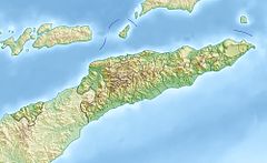
 Location of river mouth | |
| Native name |
|
| Location | |
| Country | East Timor |
| Municipality | Oecusse |
| Physical characteristics | |
| Mouth | Savu Sea |
• location | Lifau |
• coordinates | 9°12′31″S 124°18′12″E / 9.20861°S 124.30333°ECoordinates: 9°12′31″S 124°18′12″E / 9.20861°S 124.30333°E |
| Basin features | |
| Bridges | Noefefan Bridge |
The Tono River (Portuguese: Ribeira de Tono, Tetum: Mota Tono) is the main river in Oecusse, an exclave of East Timor. The river flows north, through the center of the district into the Savu Sea, reaching the sea near Lifau. The area is the main rice-producing place in Oecusse.
In June 2017 the Noefefan Bridge was inaugurated over the Tono River. The 380-meter-long bridge connects Citrana, Passabe and other isolated regions west of the Tono River to the regional capital of Pante Macassar, providing them permanent access to markets, the ferry, and airport, even on the rainy season (November to April).[1]
References[]
- Wheeler, T. (2004) East Timor. Footscray, VIC; Lonely Planet.
Categories:
- Rivers of East Timor
- Oecusse Municipality
- Asia river stubs
- East Timor geography stubs
