Totegegie Airport
Totegegie Airport | |||||||||||
|---|---|---|---|---|---|---|---|---|---|---|---|
 | |||||||||||
| Summary | |||||||||||
| Airport type | Public | ||||||||||
| Serves | Gambier Islands, French Polynesia Is the closest airport to the Pitcairn Islands | ||||||||||
| Location | Rikitea | ||||||||||
| Elevation AMSL | 7 ft / 2 m | ||||||||||
| Coordinates | 23°05′04″S 134°53′07″W / 23.08444°S 134.88528°WCoordinates: 23°05′04″S 134°53′07″W / 23.08444°S 134.88528°W | ||||||||||
| Map | |||||||||||
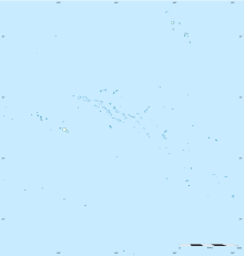 GMR Location of the airport in French Polynesia | |||||||||||
| Runways | |||||||||||
| |||||||||||
Sources: French AIP[1] | |||||||||||

Totegegie Airport (IATA: GMR, ICAO: NTGJ) is an airport on Totegegie Island in the Gambier Islands, French Polynesia. It is 9 km northeast of the village of Rikitea.
Totegegie is one of Mangareva island's reefs, approximately 9 km (5.6 mi) from Rikitea, the island's administrative settlement. It has the only building on the reef. The airport is 1,652 km (1,027 mi) from Tahiti and is classified as a territorial aerodrome. Its only commercial service is to Tahiti's Fa'a'ā International Airport on Tuesdays.[2][3]
Totegegie Airport is crucial in its role as the outside world's link to Pitcairn Island. One of the few ways a traveler can reach Pitcairn is to fly to Tahiti, then to Totegegie. From there, a 32-hour boat ride will take one to Pitcairn.[3]
History[]
The 3,500 metres (11,500 ft) runway was constructed in 1967 by the 115th running of the Society of the Pacific Experimentation Centre Pacific (CEP). The first aircraft, a Piper Aztec, landed in 1968. The same year, a DC-6 performed weekly service between Totegegie, Mururoa and Papeete. In 1978, the first commercial air link was established between Totegegie and Papeete.[4]
The French army buildings were decommissioned in 1998. At the end of operations 50 tons of scrap metal had been collected.[5]
In 2008, the terminal was expanded and modernized.
Airlines and destinations[]
Passenger[]
| Airlines | Destinations |
|---|---|
| Air Tahiti | Hao, Papeete[6] |
Ground transportation[]
The airport is connected to Mangareva and its city Rikitea by boat.
From Mangareva there are boats going to Pitcairn Island, the main way of getting there.
Passengers[]
The increase in passenger numbers is shown below. [7]
| Years | 1998 | 1999 | 2000 | 2001 | 2002 | 2003 | 2004 | 2005 | 2006 | 2007 | 2008 | 2009 | 2010 | 2011 | 2012 | 2013 | 2014 | 2015 | 2016 | 2017 |
|---|---|---|---|---|---|---|---|---|---|---|---|---|---|---|---|---|---|---|---|---|
| Passengers | 5,236 | 5,249 | 5,319 | 5,129 | 4,937 | 5,609 | 5,922 | 6,598 | 6,938 | 7,155 | 7,409 | 6,850 | 7,420 | 7,003 | 7,798 | 7,521 | 7,498 | 7,201 | 7,675 | 8,498 |
Wildlife[]
The shrub Pemphis acidula, is widespread on Polynesian atolls and is known locally as the 'miki miki'.[citation needed]
| Wikimedia Commons has media related to Totegegie Airport. |
References[]
- ^ NTGJ – TOTEGEGIE. AIP from French Service d'information aéronautique, effective 9 September 2021.
- ^ "Archived copy". Archived from the original on 2012-01-27. Retrieved 2012-06-14.CS1 maint: archived copy as title (link)
- ^ Jump up to: a b "Archived copy". Archived from the original on 2012-06-05. Retrieved 2012-06-14.CS1 maint: archived copy as title (link)
- ^ http://gadper.free.fr/public/Polynesie/les_anciens_racontent/Construction%20de%20la%20piste%20de%20Totegegie%20en%201967-1.pdf
- ^ http://www.moruroa.org/medias/pdf/T%C3%A9moignage%20Gambier%201967.pdf
- ^ "Download forecast schedule - Official website - Air Tahiti".
- ^ "Union des Aéroports Français".
This French Polynesia-related geography article is a stub. You can help Wikipedia by . |
- Airports in French Polynesia
- Gambier Islands
- Airports established in 1967
- 1967 establishments in French Polynesia
- French Polynesia geography stubs