Trelewis
| Trelewis | |
|---|---|
 Relocated Trelewis War Memorial | |
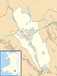 Trelewis Location within Merthyr Tydfil | |
| Population | 2,029 |
| OS grid reference | ST095975 |
| • Cardiff | 14 mi (23 km) |
| Principal area | |
| Ceremonial county | |
| Country | Wales |
| Sovereign state | United Kingdom |
| Post town | TREHARRIS |
| Postcode district | CF46 |
| Dialling code | 01443 |
| Police | South Wales |
| Fire | South Wales |
| Ambulance | Welsh |
| UK Parliament | |
| Senedd Cymru – Welsh Parliament |
|

Trelewis is a small village in the Taff Bargoed Valley of south-east Wales, currently located in the southern part of Merthyr Tydfil County Borough. It is a former mining village and together with nearby Bedlinog was until 1974 part of the area of the county of Glamorgan. The villages name means 'Lewis Town' and was named after the Lewis family who owned a farm on the area where the village is now built. It is in the community of Bedlinog.
Location[]
It is around one-third of a mile (0.5 km) north of Nelson, 3 miles (4.8 km) south of Bedlinog, and around two-thirds of a mile (1.1 km) east of the Treharris, from which it is divided by the Taff Bargoed river. It lies 5 miles (8 km) north of the town of Pontypridd, 6 miles (10 km) west of Caerphilly, and 10+1⁄2 miles (17 km) south of Merthyr Tydfil. The village is at an altitude of 490 feet (150 m).[1]
Government[]
Trelewis is in the Merthyr Tydfil County Borough, which covers the villages of Trelewis and Bedlinog, but is governed by a separate local authority, Bedlinog Community Council, which consists of nine elected members, and whose powers and responsibilities cover the two villages within its area. The Bedlinog & Trelewis Ward is the only electoral area within the Merthyr Tydfil County Borough Council area with its own Council. The Council was created in 1974 by the former prior to its abolition and the subsequent transfer of Trelewis and Bedlinog into the Merthyr administrative area upon local government reorganisation in that year, to which most people in Bedlinog and Trelewis were opposed.
History and amenities[]
During the latter nineteenth century, a coal mine opened in the village which led to a large expansion of the village. In 1878 the Trelewis school opened, this was replaced in 1984 with a new modern school.[2] There is a freight-only railway line, the Taff Bargoed branch of the former Great Western Railway, running through the village and this line carries coal from Ffos-y-fran opencast colliery. Bedlinog is to the north of Trelewis on this line, whilst Nelson is to the south.
Trelewis Welfare, a former member of the Welsh Football League, played in the village. . Trelewis also has a park and an outdoor bowls club, Trelewis Welfare Outdoor Bowls which was founded in 1932.
Location grid[]
Places adjacent to Trelewis | ||||||||||||||||
|---|---|---|---|---|---|---|---|---|---|---|---|---|---|---|---|---|
| ||||||||||||||||
References[]
- ^ "Trelewis, Merthyr Tydfil". ordnancesurvey.co.uk.
- ^ "Trelewis". treharrisdistrict.co.uk. Retrieved 23 July 2018.
External links[]
- Old Merthyr Tydfil: Trelewis - Historical Photographs of Trelewis.
- www.geograph.co.uk : photos of Trelewis and surrounding area
- www.alangeorge.co.uk : history and photographs of Trelewis
| Communities |  | |
|---|---|---|
| Towns and villages | ||
| Rivers | ||
| Topics | ||
This Merthyr Tydfil location article is a stub. You can help Wikipedia by . |
- Villages in Merthyr Tydfil County Borough
- Glamorgan geography stubs