Tremblay, Ille-et-Vilaine
Tremblay
Kreneg | |
|---|---|
Part of Val-Couesnon | |
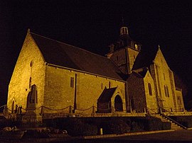 The church in Tremblay | |
show Location of Tremblay | |
 Tremblay | |
| Coordinates: 48°25′23″N 1°28′29″W / 48.4231°N 1.4747°WCoordinates: 48°25′23″N 1°28′29″W / 48.4231°N 1.4747°W | |
| Country | France |
| Region | Brittany |
| Department | Ille-et-Vilaine |
| Arrondissement | Fougères-Vitré |
| Canton | Antrain |
| Commune | Val-Couesnon |
| Area 1 | 36.22 km2 (13.98 sq mi) |
| Population (2017)[1] | 1,517 |
| • Density | 42/km2 (110/sq mi) |
| Time zone | UTC+01:00 (CET) |
| • Summer (DST) | UTC+02:00 (CEST) |
| Postal code | 35460 |
| Elevation | 10–116 m (33–381 ft) |
| 1 French Land Register data, which excludes lakes, ponds, glaciers > 1 km2 (0.386 sq mi or 247 acres) and river estuaries. | |


Tremblay (French pronunciation: [tʁɑ̃blɛ]; Breton: Kreneg) is a former commune in the Ille-et-Vilaine department of Brittany in northwestern France. On 1 January 2019, it was merged into the new commune Val-Couesnon.[2]
Population[]
Inhabitants of Tremblay are called in French tremblaisiens.
| Year | Pop. | ±% |
|---|---|---|
| 1962 | 1,707 | — |
| 1968 | 1,707 | +0.0% |
| 1975 | 1,736 | +1.7% |
| 1982 | 1,624 | −6.5% |
| 1990 | 1,453 | −10.5% |
| 1999 | 1,423 | −2.1% |
| 2009 | 1,515 | +6.5% |
See also[]
- Communes of the Ille-et-Vilaine department
References[]
- ^ Téléchargement du fichier d'ensemble des populations légales en 2017, INSEE
- ^ Arrêté préfectoral 28 September 2018 (in French)
External links[]
| Wikimedia Commons has media related to Tremblay (Ille-et-Vilaine). |
- Base Mérimée: Search for heritage in the commune, Ministère français de la Culture. (in French)
This Ille-et-Vilaine geographical article is a stub. You can help Wikipedia by . |
Categories:
- Former communes of Ille-et-Vilaine
- Ille-et-Vilaine geography stubs