Tres Ríos, Cartago
This article may require cleanup to meet Wikipedia's quality standards. The specific problem is: the writing, badly translated from Spanish, needs improvement and weeding to encyclopaedic standard, and there are hardly any references to support the text. (May 2013) |
Tres Ríos | |
|---|---|
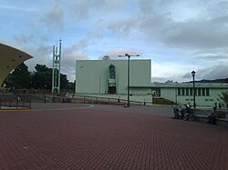 Tres Ríos church | |
 Tres Ríos district | |
 Tres Ríos Tres Ríos district location in Costa Rica | |
| Coordinates: 9°54′26″N 83°59′11″W / 9.907172°N 83.9864611°WCoordinates: 9°54′26″N 83°59′11″W / 9.907172°N 83.9864611°W | |
| Country | |
| Province | Cartago |
| Canton | La Unión |
| Area | |
| • Total | 2.19 km2 (0.85 sq mi) |
| Elevation | 1,345 m (4,413 ft) |
| Population (2011) | |
| • Total | 9,331 |
| • Density | 4,300/km2 (11,000/sq mi) |
| Time zone | UTC−06:00 |
| Postal code | 30301 |
Tres Ríos is a district of the La Unión canton, in the San José province of Costa Rica.[1][2]
Toponymy[]
Tres Ríos is translated as Three Rivers, named so due to the confluence of Tiribí, Chiquito and Cruz rivers.
History[]
This section needs additional citations for verification. (May 2013) |
In pre-Columbian times this area, now in the canton of La Unión, was inhabited by Indians of the North Huetar kingdom, domains of the chief Guarco. At the time of the conquest the principal chief of the region was Guarco's son, Correque.
In the eighteenth century some parish priests from the Church of the Holy Spirit of Esparza, accompanied by natives of Salamanca, were heading to the city of Cartago. On their way they traveled through the valley of Tres Ríos, as it was called at that time. They settled there, thus giving rise to a more stable population.
They built a small chapel that was dedicated to the Our Lady of the Pillar, whose image had been given to them by Bishop Heredia. Thus the fledgling town was named for Nuestra Señora del Pilar de los Tres Ríos.
Geography[]
Tres Ríos has an area of 2.19 km²[3] and an elevation of 1,345 metres.[1]
Demographics[]
| Historical population | |||
|---|---|---|---|
| Census | Pop. | %± | |
| 1883 | 852 | — | |
| 1892 | 1,077 | 26.4% | |
| 1927 | 1,540 | 43.0% | |
| 1950 | 2,837 | 84.2% | |
| 1963 | 4,694 | 65.5% | |
| 1973 | 6,804 | 45.0% | |
| 1984 | 8,661 | 27.3% | |
| 2000 | 10,009 | 15.6% | |
| 2011 | 9,331 | −6.8% | |
|
Instituto Nacional de Estadística y Censos[4] |
|||
For the 2011 census, Tres Ríos had a population of 9,331 inhabitants.[6]
Transportation[]
Road transportation[]
The district is covered by the following road routes:
Rail transportation[]
The district is covered by the passenger Interurbano Line operated by Incofer. There is an unmanned platform stop in the north of the district, at Plaza Barcelona shopping center.
Economy[]
Coffee[]
Tres Ríos, but particularly its surroundings, is one of the eight recognized coffee production areas in the country. The regional coffee flavor is due to the high fertility and composition of the local soils, which have been enriched by minerals in the various eruptions of Irazú Volcano (last in 1963) and to an ideal balance of moisture from rains and warm summers.[7][8]
Due to a dynamic urban growth in the metropolitan area of Costa Rica in the late twentieth century, the land use has progressively changed from agricultural to suburban, forcing the elimination of dozens of coffee farms. However, the Tres Rios area, particularly neighboring districts of Concepción and San Ramón in the same La Unión canton, still continues to grow coffee beans for the gourmet market.
The economy of Tres Rios is now diversified and no longer depends only on the cultivation of coffee. Urban development and geographical location close to other densely populated metropolitan suburbs and midway between the cities of San José and Cartago have oriented its economy to trade and services, including the development of many private schools.[7]
External links[]
References[]
- ^ a b "Declara oficial para efectos administrativos, la aprobación de la División Territorial Administrativa de la República N°41548-MGP". Sistema Costarricense de Información Jurídica (in Spanish). 19 March 2019. Retrieved 26 September 2020.
- ^ División Territorial Administrativa de la República de Costa Rica (PDF) (in Spanish). Editorial Digital de la Imprenta Nacional. 8 March 2017. ISBN 978-9977-58-477-5.
- ^ "Área en kilómetros cuadrados, según provincia, cantón y distrito administrativo". Instituto Nacional de Estadística y Censos (in Spanish). Retrieved 26 September 2020.
- ^ "Instituto Nacional de Estadística y Censos" (in Spanish).
- ^ "Sistema de Consulta de a Bases de Datos Estadísticas". Centro Centroamericano de Población (in Spanish).
- ^ "Censo. 2011. Población total por zona y sexo, según provincia, cantón y distrito". Instituto Nacional de Estadística y Censos (in Spanish). Retrieved 26 September 2020.
- ^ a b "Coffee From The Tres Rios Region of Costa Rica". Retrieved 2013-05-23.
- ^ "Tres Ríos". ICAFE. Retrieved 30 September 2020.
| Cartago |
|
|---|---|
| Paraíso | |
| La Unión | |
| Jiménez |
|
| Turrialba |
|
| Alvarado |
|
| Oreamuno |
|
| El Guarco |
|
- Districts of Cartago Province
- Populated places in Cartago Province