Trift Glacier
| Trift Glacier | |
|---|---|
| Triftgletscher | |
 Trift Glacier in September 2007 | |
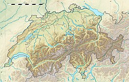
 Trift Glacier Location in Switzerland | |
| Location | Canton of Berne, Switzerland |
| Coordinates | 46°39′40″N 8°22′40″E / 46.66111°N 8.37778°ECoordinates: 46°39′40″N 8°22′40″E / 46.66111°N 8.37778°E |
| Length | 5 km |
The Trift Glacier (German: Triftgletscher) is a 5 km (3.1 mi) long glacier (2005) in the Urner Alps near Gadmen, in the extreme east of the canton Berne in Switzerland.[1]

Morphology[]
In 1973 glacier was 5.75 km long, 3 km wide at the top and around 500 m wide at it tongue. Overall it covered an area of 16.55 km2 (6.39 sq mi) including glacier sides. [2]
Since the end of the Little Ice Age, the Trift Glacier is shrinking. The valley in which lake Triftsee is today used to be filled by a large mass of ice well into the 20th century. In the 1990s small puddles of melt water began to form at the glacier tongue and gradually became larger. In the hot summer of 2003, the lake quickly grew and the glacier tongue sank into the melt water and dissolved in it, which led to a shrinkage of the glacier of more than 136 m within a year. Since 1861, the glacier has shrunk a total of 2771 meters.
Tourist attractions[]
At an altitude of 2520 meters above sea level is the Trifthutte , a mountain hut of the Schweizer Alpen-Club (SAC) that was only accessible via the glacier tongue. Due to the melting of the glacier, in 2004 people were forced to build a bridge, the Triftbrücke to reach this hut.
See also[]
References[]
| Wikimedia Commons has media related to Trift Glacier. |
- ^ Reynolds, Kev (2011). Walking in the Alps: A Comprehensive Guide to Walking and Trekking throughout the Alps. Kendal, UK: Cicerone Press. p. 197.
- ^ (in German) Triftgletscher Gadmen, Schweizerisches Gletschermessnetz
External links[]
- Glaciers of Switzerland
- Glaciers of the Alps
- Aare basin
- Canton of Bern geography stubs
