Troy VII
| UNESCO World Heritage Site | |
|---|---|
 | |
| Location | Çanakkale Province, Turkey |
| Part of | Archaeological Site of Troy |
| Criteria | Cultural: (ii)(iii)(vi) |
| Reference | 849 |
| Inscription | 1998 (22nd Session) |
| Coordinates | 39°57′23″N 26°14′20″E / 39.95639°N 26.23889°ECoordinates: 39°57′23″N 26°14′20″E / 39.95639°N 26.23889°E |
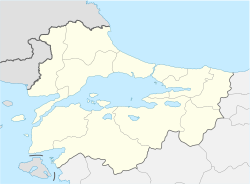 Location of Troy VII in Marmara | |


Troy VII is an archaeological layer at Hisarlik which corresponds to the city of Troy from roughly 1300 to 950 BC. It was a walled city comprising a citadel surrounded by a large lower town, described by Manfred Korfmann as "by the standards of its day a large and important city".[1] One of its sublayers has been considered as a candidate for the city which inspired the legends of the Trojan War.
Periodization[]
The early layers of Troy VII were contemporary with the late period of Mycenaean culture and the Hittite Empire. The later layers were contemporary with the Greek Dark Ages and the Neo-Hittite states. Archaeologists divide Troy VII into the following sublayers:
- Troy VIIa: ca. 13th century BC
- Troy VIIb1: 12th century BC
- Troy VIIb2: 11th century BC
- Troy VIIb3: until c. 950 BC
VIIa[]
Troy VIIa was built around 1300 BC, soon after the destruction of its predecessor Troy VIh.[2] The city carried on its previous cultural traditions and reused or restored many earlier buildings.[3][2] However, the citadel walls were topped with new mudbrick breastworks and a dense residential neighborhood filled the citadel's previously open courtyards.[4][2] Overseas trade declined, and residents of the citadel buried storage jars in their homes, seemingly worried about impending shortages.[3] Trevor Bryce suggests that Troy VII was "a city which, though still occupied by its previous inhabitants, had suffered a severe setback of one kind or another from which it never recovered".[3]
Troy VIIa stood for a century before it was destroyed around 1180 BC.[5] Its destruction has been attributed to enemy attack, though the culprits could not have been a confederation of Mycenaean kings whose own cities had already been destroyed.[5] Partial human remains were found in houses and in the streets, and near the north-western ramparts a human skeleton with skull injuries and a broken jawbone. Three bronze arrowheads were found, two in the fort and one in the city.[citation needed]
Until excavations in 1988, one of the problems with this identification was that Troy VII seemed to be a hillfort, and not a city of the size described by Homer. The 1988 discovery of a small section of a possible city circuit wall, which was found after excavation to be a ditch, enclosed a much larger area suggesting a city "at least ten times larger than earlier excavators — and thus the broader public — had supposed".[1]
VIIb[]

After the destruction of Troy VIIa, the former inhabitants rebuilt within the city's former walls.[5] They continued making pottery in the local Anatolian Grey Ware style, and continued to have some limited foreign contacts, including with Greece.[5] The second sublayer, VIIb2 displays striking cultural differences including a new knobbed style of pottery known as Buckelkeramik. Thus, Troy VIIb2 appears to have been influenced by a new immigrant population from south-eastern Europe.[5] Troy VIIb2 was destroyed by fire around 1000 BC, during the Greek Protogeometric period.[5]
Problems with periodization[]
The standard periodization of the site was developed by Wilhelm Dörpfeld. Modern archaeologists interpret VIIa as a continuation of VIh, and some have proposed to relabel it as VIi. Similarly, levels VIIb1 and VIIb2 have been argued to belong as part of Troy VI. However, Dorpfeld's periodization continues to be used as the standard in order to avoid confusion.[6]
Excavation history[]
It was first excavated by Western Europeans in the second half of the 19th century; first by the Englishman Frank Calvert and afterwards by the German businessman and treasure hunter Heinrich Schliemann, who is generally credited with its recovery. As early as 1822, Hisarlik was identified by Charles Maclaren as a possible site of Homeric Troy.[7] In 1847, his brother Frederick bought a farm of over 2,000 acres (8 km²) at Akca Koy, including part of Mount Hisarlik.
See also[]
- Bronze Age collapse
- Historicity of the Iliad
References[]
- ^ Jump up to: a b Joachim Latacz. Troy and Homer: towards a solution of an old mystery. Oxford University Press, 2004. ISBN 0-19-926308-6. Page 38.
- ^ Jump up to: a b c Jablonka, Peter (2010). "Troy". In Cline, Eric (ed.). The Oxford Handbook of the Bronze Age Aegean. Oxford University Press. p. 855. doi:10.1093/oxfordhb/9780199873609.013.0063.
- ^ Jump up to: a b c Bryce, Trevor (2006). The Trojans and their Neighbors. Routledge. p. 66. ISBN 0-415-34955-9.
- ^ Bryce, Trevor (2006). The Trojans and their Neighbors. Routledge. p. 66. ISBN 0-415-34955-9.
- ^ Jump up to: a b c d e f Bryce, Trevor (2006). The Trojans and their Neighbors. Routledge. p. 67. ISBN 0-415-34955-9.
- ^ Bryce, Trevor (2006). The Trojans and their Neighbors. Routledge. p.198, note 12. ISBN 0-415-34955-9.
- ^ Hisarlık -- Britannica Online Encyclopedia at www.britannica.com
External links[]
- 14th-century BC establishments
- Populated places established in the 2nd millennium BC
- Populated places disestablished in the 10th century BC
- 1822 archaeological discoveries
- Troy
- Greek Dark Ages