Tuliszków
Tuliszków | |
|---|---|
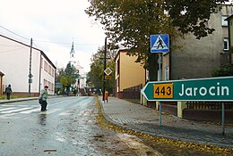 Street in Tuliszków with Church of Saint Vitalis in the far background | |
 Coat of arms | |
 Tuliszków | |
| Coordinates: 52°4′36″N 18°17′38″E / 52.07667°N 18.29389°E | |
| Country | |
| Voivodeship | Greater Poland |
| County | Turek |
| Gmina | Tuliszków |
| Area | |
| • Total | 7.04 km2 (2.72 sq mi) |
| Population (2006) | |
| • Total | 3,393 |
| • Density | 480/km2 (1,200/sq mi) |
| Postal code | 62-740 |
| Website | http://www.tuliszkow.pl |

Tuliszków pronounced [tuˈliʂkuf] is a town in Turek County, Greater Poland Voivodeship, Poland, with 3,406 inhabitants (2004). In World War II, Tuliszków was home to one of the first Jewish ghettos in German-occupied Poland following the Nazi German and Soviet invasion of 1939. The ghetto was formed in December 1939 or January 1940.
History[]
The oldest mention of Tuliszków in 1320 originates from the Chronicle of Kacper Niesiecki,[1] written three centuries later.[2] Known in Latin as Tviliskow, Tuliscov, or Tuliscovo (meaning, fox grounds), it received town privileges in 1458 after the Battle of Grunwald. Featured in the Tuliszków coat-of-arms is the knight 'Janusz z Tuliszkowa' holding his Grunwald sword. The town grew substantially in the 19th century, although stripped of town privileges by the tsar in 1870 as revenge for the January Uprising against the Russian occupation. Much of the town was consumed by fire in 1881. The population of Tuliszków was approximately 2,000 in the beginning of the 20th century. Following Poland's return to independence the city rights were restored. In the Second Polish Republic the population grew to 2,600 before 1939.[3]
Jewish community[]
The Jewish community was 250 people in the 1921 census,[4] led by Rabbi Joel Foks, member of Mizrachi. The economic crisis of the 1930s forced some families to leave in search of a better life.[4]
Soon after the invasion of Poland by Nazi Germany, on October 8, 1939 the first ever ghetto of World War II was set up at Piotrków Trybunalski . After that ghettos were established in most communities in Poland. Jews were moved into the poorest parts of town and forced to live in squalor with multiple people occupying each room.[5]
There were only 230 Jews in Tuliszków at the onset of war, around 10% of the general population. In December 1939 the invading Germans ordered the creation of a Judenrat and forced all adult Jews to wear the Star of David; the community was stripped of money and valuables. Within weeks the ghetto was formed, and electricity was cut off from it in the dead of winter. Stronger Jews were pressed to forced labour. The ghetto was liquidated in October 1941 and all Jews – men, women and children – deported to transit ghetto in Kowale Pańskie. Some escaped from that ghetto and returned to Tuliszkow to hide. Others were sent to forced labor camps near Poznan or to Lodz. Most of those in the Kowale Pańskie ghetto were sent to Chełmno extermination camp.[4] Only one Tuliszkow Jew is known to have survived the war.[6]
See also[]
- Jewish ghettos in German-occupied Poland
References[]
- ^ Historia Tuliszkowa (2016). "Zapis w Kronice Kacpra Niesieckiego" (PDF). Janko Kasztelan Kaliski W Roku 1320 W Tuliszkowie Pogrzebiony. Stowarzyszenie 'Solidarni w Partnerstwie'. Archived from the original (PDF) on 2016-10-07.
- ^ Jacek Maj (2016). "Biogram Kaspra Niesieckiego". Forum Akademickie. Cite journal requires
|journal=(help) - ^ Urząd Gminy w Tuliszkowie (2016). "Tuliszków. Rys historyczny". Urząd Miasta Tuliszków, Gmina Tuliszków. Cite journal requires
|journal=(help) - ^ Jump up to: a b c Magdalena Wójcik (2016). "Tuliszków - Historia". Społeczność żydowska przed 1989. Wirtualny Sztetl, Muzeum Historii Żydów Polskich POLIN.
- ^ "Piotrkow Trybunalski" (PDF). Shoah Resource Center. Yad Vashem, The Holocaust Martyrs' and Heroes' Remembrance Authority.
- ^ Megargee, Geoffrey (2012). Encyclopedia of Camps and Ghettos. Bloomington, Indiana: University of Indiana Press. p. Volume II, 108–109. ISBN 978-0-253-35599-7.
| hide | ||
|---|---|---|
| Town and seat |  | |
| Villages | ||
| show Authority control |
|---|
Coordinates: 52°04′35″N 18°17′35″E / 52.07639°N 18.29306°E
- Cities and towns in Greater Poland Voivodeship
- Turek County
- Holocaust locations in Poland