Turner Glacier
| Turner Glacier | |
|---|---|
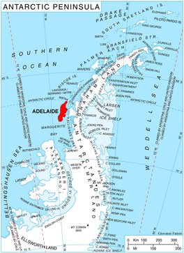 Location of Adelaide Island in the Antarctic Peninsula | |
 Location of Turner Glacier in Antarctica | |
| Location | Adelaide Island |
| Coordinates |  67°37′S 68°29′W / 67.617°S 68.483°W / -67.617; -68.483 67°37′S 68°29′W / 67.617°S 68.483°W / -67.617; -68.483 |
| Thickness | unknown |
| Terminus | Ryder Bay |
| Status | unknown |
Turner Glacier ( WikiMiniAtlas67°37′S 68°29′W / 67.617°S 68.483°W / -67.617; -68.483) is a glacier on the east side of Mount Liotard flowing northeast into Ryder Bay, Adelaide Island. The glacier was surveyed by Falkland Islands Dependencies Survey (FIDS), 1948, and photographed from the air by Falkland Islands and Dependencies Aerial Survey Expedition (FIDASE), 1956–57. Named by the United Kingdom Antarctic Place-Names Committee (UK-APC) in 1977 after Andrew John Turner, British Antarctic Survey (BAS) builder, Halley Station, 1973–74; Signy Island, 1974–75; Rothera Station, 1976–77, 1978–80; and Faraday Station, 1982–83.
It should not be confused with the Turner Glacier on Baffin Island in Nunavut, Canada, adjoining Mount Asgard.
See also[]
- List of glaciers in the Antarctic
- Glaciology
![]() This article incorporates public domain material from the United States Geological Survey document: "Turner Glacier". (content from the Geographic Names Information System)
This article incorporates public domain material from the United States Geological Survey document: "Turner Glacier". (content from the Geographic Names Information System) ![]()
Adelaide Island | |||||||||
|---|---|---|---|---|---|---|---|---|---|
| Stations and bases |
| ||||||||
| Hills, peaks, and nunatuks |
| ||||||||
| Glaciers |
| ||||||||
| Other inland features |
| ||||||||
| Coastal features |
| ||||||||
| Off-shore |
| ||||||||
Glaciers in the Antarctic | |
|---|---|
|
Geography of West Antarctica | |
|---|---|
| Areas |
|
| Major ice shelves |
|
| Seas and major islands |
|
This Adelaide Island location article is a stub. You can help Wikipedia by . |
- v
- t
This article about a glacier in Graham Land is a stub. You can help Wikipedia by . |
- v
- t
- Glaciers of Adelaide Island
- Adelaide Island geography stubs
- Graham Land glacier stubs
- Articles with short description
- Short description matches Wikidata
- Coordinates on Wikidata
- Wikipedia articles incorporating text from the USGS Geographic Names Information System
- All stub articles