Tuting
Tuting
pekong | |
|---|---|
town | |
 Tuting Location in Arunachal Pradesh, India | |
| Coordinates: 28°59′32″N 94°53′41″E / 28.992185°N 94.894697°ECoordinates: 28°59′32″N 94°53′41″E / 28.992185°N 94.894697°E | |
| Country | |
| State | Arunachal Pradesh |
| District | Upper Siang district |
| Elevation | 1,240 m (4,070 ft) |
| Languages | |
| • Official | Hindi, English |
| Time zone | UTC+05:30 (IST) |
| ISO 3166 code | IN-AR |
| Vehicle registration | AR |

Tuting is a town on the bank of Brahmaputra at a distance of 34 km south of McMahon Line and 170 kilometres north of Yingkiong in Upper Siang district in the north-eastern state of Arunachal Pradesh in India.[1][2] It is where the panchayat, assembly constituency, and Indian Military headquarters is. Since Tuting lies near the Line of Actual Control (LAC), an area disputed by India-China, the border area was in spotlight in January 2018 due to Chinese People's Liberation Army incursion and attempted construction of roads inside Indian territory.[3][2]
Location[]
It is located on the 2,000-kilometre-long (1,200 mi) proposed Mago-Thingbu to Vijaynagar Arunachal Pradesh Frontier Highway along the McMahon Line,[4][5][6][7] alignment map of which can be seen here and here.[8] Around 35 km upstream is Gelling, the last India village before the Indo-Tibet border.[9] Tsangpo river (Brahmaputra) enters here from Tibet and natives know it as the Tsang Chu, downstream of here it is called the Siang river and Bramhaputra in Assam.[2]
Administration[]
Tuting-Yingkiong is one of the Arunachal Pradesh Legislative Assembly. Tuting town is under the administration of an (ADC) Additional Deputy Commissioner.[10][11] Tuting town is the head office of the ADC.[10]
Culture[]
Tuting is populated by Adi tribe who are the indigenous inhabitants but small population of other neighbouring tribes like Memba and Khamba are also settled in this town nowadays.[10]
In Gelling circle in northern reaches of Tuting, Memba people are indigenous tribe who follow Nyingma Mahayana Buddhism whose key festivals of Losar, Torgya, Dhruba and Tsobum are celebrated by performing Bardo Chham animal-mask folk dance at gonpas.[2]
Tourism[]
Gelling, with 3 hour foot track to Indo-China border, is a tourist attraction which has Dampo Tso lake, 300 ft tall Sibe-Re waterfallat Bishing 3 hour trekking from Gelling, remnants of now defunct Kapangla Pass between Tibet and India, and Inspection Bungalow at Gelling for stay. Trekking and scenery.[2]
Transport[]
Highway[]
Tuting is connected to Yingkiong and Pasighat in the south and till ITBF office at Gelling in the north on the LAC via the Pasighat-Aalo-Tuting-Gelling strategic India-China Border Roads.
Tuting Airport[]
Tuting AGL is an Advanced Landing Ground airstrip of Indian Airforce.
Map[]
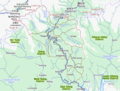
Upper Siang district with Tuting circle and Tuting

See also[]
- North-East Frontier Agency
- List of people from Arunachal Pradesh
- Religion in Arunachal Pradesh
- Cuisine of Arunachal Pradesh
- List of institutions of higher education in Arunachal Pradesh
- Yingkiong
Capital: Itanagar | |
| State symbols |
|
| Topics |
|
| Administration | |
| Divisions |
|
| Districts |
|
| Major Towns |
|
| Historical Places |
|
Portal: India | |
| Leadership |
| ||||||||||||||||||||||||||||||||||||||||||||
|---|---|---|---|---|---|---|---|---|---|---|---|---|---|---|---|---|---|---|---|---|---|---|---|---|---|---|---|---|---|---|---|---|---|---|---|---|---|---|---|---|---|---|---|---|---|
| Components & commands |
| ||||||||||||||||||||||||||||||||||||||||||||
| Military academies |
| ||||||||||||||||||||||||||||||||||||||||||||
| Insignia |
| ||||||||||||||||||||||||||||||||||||||||||||
| History & future |
| ||||||||||||||||||||||||||||||||||||||||||||
| Other | |||||||||||||||||||||||||||||||||||||||||||||
| |||||||||||||||||||||||||||||||||||||||||||||
| States |
|
|---|---|
| Union territories |
|
| |
References[]
- ^ Town. "Tuting". Times of India Travel. Retrieved 23 March 2019.
- ^ a b c d e "Place of interest | District Upper Siang, Government of Arunachal Pradesh". Retrieved 7 February 2021.
- ^ "Chinese road-building team entered 1km inside Arunachal, sent back by Indian Army: Sources". The Times of India. Retrieved 24 December 2018.
- ^ "Top officials to meet to expedite road building along China border". Dipak Kumar Dash. timesofindia.indiatimes.com. Retrieved 27 October 2014.
- ^ "Narendra Modi government to provide funds for restoration of damaged highways". dnaindia.com. Retrieved 27 October 2014.
- ^ "Indian Government Plans Highway Along Disputed China Border". Ankit Panda. thediplomat.com. Retrieved 27 October 2014.
- ^ "Govt planning road along McMohan line in Arunachal Pradesh: Kiren Rijiju". Live Mint. Retrieved 26 October 2014.
- ^ "China warns India against paving road in Arunachal". Ajay Banerjee. tribuneindia.com. Retrieved 26 October 2014.
- ^ "Gelling". Content Owned by District Administration. Developed and hosted by National Informatics Centre, Ministry of Electronics & Information Technology, Government of India. Government of Arunachal Pradesh. Retrieved 17 June 2021.
{{cite web}}: CS1 maint: others (link) CS1 maint: url-status (link) - ^ a b c "Districts Officials". Arunachal Pradesh, Official State Portal. Retrieved 23 March 2019.
- ^ "Subdivision & Blocks | District Upper Siang, Government of Arunachal Pradesh". Retrieved 23 March 2019.
Places adjacent to Tuting | ||||||||||||||||
|---|---|---|---|---|---|---|---|---|---|---|---|---|---|---|---|---|
| ||||||||||||||||
- Cities and towns in Upper Siang district