Twatt, Orkney
| Twatt | |
|---|---|
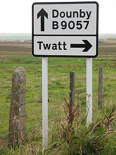 Road sign pointing to Twatt | |
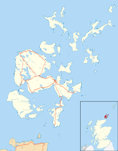 Twatt Location within Orkney | |
| OS grid reference | HY270242 |
| Civil parish | |
| Council area |
|
| Lieutenancy area |
|
| Country | Scotland |
| Sovereign state | United Kingdom |
| Post town | ORKNEY |
| Postcode district | KW17 |
| Dialling code | 01856 |
| Police | Scotland |
| Fire | Scottish |
| Ambulance | Scottish |
| UK Parliament | |
| Scottish Parliament | |

Twatt is a small settlement in the parish of Birsay on the Mainland of the Orkney Islands, Scotland. It was previously the location of RNAS Twatt (HMS Tern),1940–1949.[1][2][3] Twatt is situated at the junction of the A986 and the A967.[4][5]
Etymology[]


The settlement name originates from the Old Norse þveit, meaning 'small parcel of land'. The Norse word commonly produces in England the place name element Thwaite.
The name Twatt is similar to the common English expletive "twat", (an insulting word used to express contempt or derision for another individual, although it can also colloquially refer to a vagina). Its name featured at number four in a list of the most vulgar-sounding names in Rude Britain, along with its Shetland counterpart. There is also an Upper Twatt Road on the island in Stenness.[6]
Local services[]
A post office opened at Twatt on 1 November 1879. It closed on 10 April 2002.[7]
References[]
- ^ "RNAS Twatt airfield, HMS Tern". Control Towers.co.uk. Retrieved 13 October 2007.
- ^ "Twatt". Abandoned, Forgotten and Little Known Airfields in Europe. Retrieved 10 November 2014.
- ^ "Twatt Airfield". Canmore. Royal Commission on the Ancient and Historical Monuments of Scotland. Retrieved 10 November 2014.
- ^ "A986". Sabre. Retrieved 1 January 2015.
- ^ "A967". Sabre. Retrieved 1 January 2015.
- ^ "Orkney Islands Council - Development and Environment Services - List of public roads as of 1 December 2010" (PDF). Orkney Islands Council. Archived from the original (PDF) on 23 October 2014. Retrieved 18 October 2014.
- ^ Forster, Ken: "Goodbyes & hellos", Stamp Magazine, September 2002, page 46.
External links[]
| Wikimedia Commons has media related to Twatt, Orkney Islands. |
This Orkney location article is a stub. You can help Wikipedia by . |
- Villages on Mainland, Orkney
- Orkney geography stubs