Ugarit
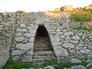 Entrance to the Royal Palace of Ugarit | |
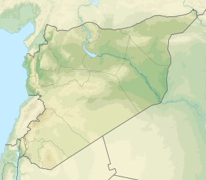
 Shown within Near East | |
| Alternative name | Ras Shamra (Arabic: رأس شمرة) |
|---|---|
| Location | Latakia Governorate, Syria |
| Region | Fertile Crescent |
| Coordinates | 35°36′07″N 35°46′55″E / 35.602°N 35.782°E |
| Type | settlement |
| History | |
| Founded | c. 6000 BCE |
| Abandoned | c. 1185 BCE |
| Periods | Neolithic–Late Bronze Age |
| Cultures | Canaanite |
| Events | Bronze Age Collapse |
| Site notes | |
| Excavation dates | 1928–present |
| Archaeologists | Claude F. A. Schaeffer |
| Condition | ruins |
| Ownership | Public |
| Public access | Yes |

Ugarit (/juːˈɡɑːrɪt, uː-/;[1] Ugaritic: