Ulvila
Ulvila
Ulvsby | |
|---|---|
Town | |
| Ulvilan kaupunki Ulvsby stad | |
 Ulvila Church | |
 Coat of arms | |
 Location of Ulvila in Finland | |
| Coordinates: 61°26′N 021°54′E / 61.433°N 21.900°ECoordinates: 61°26′N 021°54′E / 61.433°N 21.900°E | |
| Country | |
| Region | Satakunta |
| Sub-region | Pori sub-region |
| Charter (as a town) | 1365 |
| Lost town privileges | 1558 |
| Gained town privileges | 2000 |
| Government | |
| • Town manager | Mikko Löfbacka |
| Area (2018-01-01)[1] | |
| • Total | 422.51 km2 (163.13 sq mi) |
| • Land | 400.70 km2 (154.71 sq mi) |
| • Water | 21.82 km2 (8.42 sq mi) |
| Area rank | 204th largest in Finland |
| Population (2021-03-31)[2] | |
| • Total | 12,724 |
| • Rank | 82nd largest in Finland |
| • Density | 31.75/km2 (82.2/sq mi) |
| Population by native language | |
| • Finnish | 98.9% (official) |
| • Swedish | 0.2% |
| • Others | 0.8% |
| Population by age | |
| • 0 to 14 | 16.5% |
| • 15 to 64 | 56.7% |
| • 65 or older | 26.8% |
| Time zone | UTC+02:00 (EET) |
| • Summer (DST) | UTC+03:00 (EEST) |
| Municipal tax rate[5] | 21.5% |
| Climate | Dfb |
| Website | www.ulvila.fi |

Ulvila (Swedish: Ulvsby) is a town and municipality of Finland. It is one of the six medieval cities of Finland, as well as the third oldest in the country. Its position as city it had since the 14th century, was taken over by Pori in the 16th century.
It is located in the province of Western Finland and is part of the Satakunta region. Ulvila is located just 9 kilometres (5.6 mi) southeast of the city of Pori along Highway 2. The municipality has a population of 12,724 (31 March 2021)[2] and covers an area of 422.51 square kilometres (163.13 sq mi) of which 21.82 km2 (8.42 sq mi) is water.[1] The population density is 31.75 inhabitants per square kilometre (82.2/sq mi).
The municipality is unilingually Finnish.
The medieval St. Olaf's Church is dedicated to St. Olaf, who also is portrayed in the arms of the municipality.
Politics[]
Results of the Finnish municipal elections 2012 in Ulvila:[6]
- Social Democratic Party 29,0%
- National Coalition Party 24,1%
- Centre Party 15,4%
- Left Alliance 12.9%
- True Finns 11,1%
- Christian Democrats 4,0%
- Green League 3,5%
International relations[]
Twin towns — Sister cities[]
Ulvila is twinned with:
 Ljusdal Municipality, Sweden
 Suure-Jaani, Estonia
Gallery[]
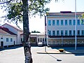
A high school in Friitala, Ulvila

A primary school in Friitala, Ulvila

A Nummela suburb in Ulvila
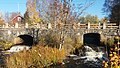
Leineperi Bridge

Saari Manor
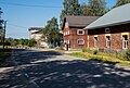
A Kaasmarkku village

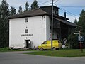
An old mill called Äijän mylly in Kullaa
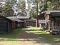
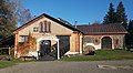
Jalomäki in Kullaa
Leineperi's wrought iron foundry
Leineperi mill

Leineperi blast furnace

Harjunpää River in Kullaa
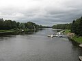
Kokemäki River at Ulvila


See also[]
- Finnish national road 2
- Finnish national road 11
- Kokemäki
- Kullaa
- Ulvila Old Town
- 2006 Ulvila homicide case
References[]
- ^ Jump up to: a b "Area of Finnish Municipalities 1.1.2018" (PDF). National Land Survey of Finland. Retrieved 30 January 2018.
- ^ Jump up to: a b "Preliminary population structure by area, 2021M01*-2021M03*". StatFin (in Finnish). Statistics Finland. Retrieved 2 May 2021.
- ^ "Population according to language and the number of foreigners and land area km2 by area as of 31 December 2008". Statistics Finland's PX-Web databases. Statistics Finland. Retrieved 29 March 2009.
- ^ "Population according to age (1-year) and sex by area and the regional division of each statistical reference year, 2003-2020". StatFin. Statistics Finland. Retrieved 2 May 2021.
- ^ "List of municipal and parish tax rates in 2021" (PDF). Tax Administration of Finland. 1 December 2020. Retrieved 10 April 2021.
- ^ "Satakunnan vaalipiiri - Ulvila - Puolueiden kannatus" (in Finnish). Yle. 6 November 2012. Retrieved 19 January 2015.
External links[]
![]() Media related to Ulvila at Wikimedia Commons
Media related to Ulvila at Wikimedia Commons
- Town of Ulvila – Official website, finnish, english

| show Authority control |
|---|
This Western Finland location article is a stub. You can help Wikipedia by . |
- Ulvila
- Cities and towns in Finland
- Medieval Finnish towns
- Populated places established in the 1360s
- Western Finland Province geography stubs