Umeyashiki Station (Tokyo)
 Umeyashiki Station 梅屋敷駅 | |
|---|---|
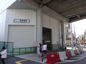 The station entrance in August 2016 | |
| Location | 2-28-1O Kamata, Ota-ku, Tokyo Japan |
| Operated by | Keikyu Corporation |
| Line(s) | |
| Distance | 8.4 km from Sengakuji |
| Platforms | 2 side platforms |
| Tracks | 2 |
| Other information | |
| Station code | KK10 |
| Website | Official website |
| History | |
| Opened | 1 February 1901 |
| Rebuilt | 2012 |
| Passengers | |
| FY2011 | 13,542 daily |
| Location | |
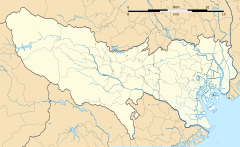 Umeyashiki Station Location within Tokyo | |
Umeyashiki Station (梅屋敷駅, Umeyashiki-eki) is a railway station on the Keikyu Main Line in Ōta, Tokyo, Japan, operated by the private railway operator Keikyu. It is numbered "KK10".
Lines[]
Umeyashiki Station is served by the Keikyu Main Line, and lies 8.4 km from the starting point of the line at Sengakuji.[1]
Layout[]
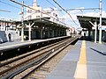
The station has two elevated side platforms serving two tracks. Before the station was rebuilt, the station was long enough to only handle 4-car trains.
Platforms[]
| 1 | ■ Keikyu Main Line | for Yokohama, Shinzushi, Uraga, and Misakiguchi |
| 2 | ■ Keikyu Main Line | for Shinagawa, Sengakuji A Toei Asakusa Line for Oshiage KS Keisei Main Line for Narita Airport |

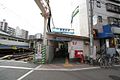
The ticket barriers in August 2016

The platforms in August 2016


Adjacent stations[]
| « | Service | » | ||
|---|---|---|---|---|
| Keikyu Main Line | ||||
| Airport Limited Express: Does not stop at this station | ||||
| Limited Express (Kaitoku): Does not stop at this station | ||||
| Limited Express (Tokkyū): Does not stop at this station | ||||
| Airport Express: Does not stop at this station | ||||
| Ōmorimachi | Local | Keikyū Kamata | ||
History[]
The station opened on 1 February 1901.[1]
The station was rebuilt with elevated tracks, completed in October 2012.[1]

The station entrance in September 2005 before rebuilding
The west entrance in October 2007 before rebuilding
The ground-level platforms in November 2008 before rebuilding

The elevated platforms under construction in August 2010


Passenger statistics[]
In fiscal 2011, the station was used by an average of 13,542 passengers daily.[1]
Surrounding area[]
- Umeyashiki Park
- Toho University Omori Campus
- Tokyo Biotechnology College
- Ota City General Gymnasium
See also[]
References[]
- ^ Jump up to: a b c d Terada, Hirokazu (19 January 2013). データブック日本の私鉄 [Databook: Japan's Private Railways]. Japan: Neko Publishing. p. 233. ISBN 978-4-7770-1336-4.
External links[]
| Wikimedia Commons has media related to Umeyashiki Station (Tokyo). |
- Official website (in Japanese)
Coordinates: 35°34′01″N 139°43′42″E / 35.5670°N 139.7284°E

- Stations of Keikyu
- Railway stations in Tokyo
- Railway stations in Japan opened in 1901