Union Grove, Texas
Union Grove, Texas | |
|---|---|
 Location of Union Grove, Texas | |
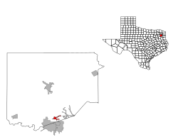 | |
| Coordinates: 32°35′0″N 94°54′35″W / 32.58333°N 94.90972°WCoordinates: 32°35′0″N 94°54′35″W / 32.58333°N 94.90972°W | |
| Country | United States |
| State | Texas |
| County | Upshur |
| Area | |
| • Total | 0.95 sq mi (2.45 km2) |
| • Land | 0.94 sq mi (2.42 km2) |
| • Water | 0.01 sq mi (0.03 km2) |
| Elevation | 410 ft (125 m) |
| Population (2010) | |
| • Total | 357 |
| • Estimate (2019)[2] | 385 |
| • Density | 411.76/sq mi (159.04/km2) |
| Time zone | UTC-6 (Central (CST)) |
| • Summer (DST) | UTC-5 (CDT) |
| FIPS code | 48-74312[3] |
| GNIS feature ID | 1379192[4] |

Union Grove is a city in Upshur County, Texas, United States. The population was 357 at the 2010 census.
Geography[]
Union Grove is located at 32°35′0″N 94°54′35″W / 32.58333°N 94.90972°W (32.583227, -94.909607).[5]
According to the United States Census Bureau, the city has a total area of 1 square mile (2.6 km2) , all of it land.[citation needed]
Demographics[]
| Historical population | |||
|---|---|---|---|
| Census | Pop. | %± | |
| 1980 | 344 | — | |
| 1990 | 271 | −21.2% | |
| 2000 | 346 | 27.7% | |
| 2010 | 357 | 3.2% | |
| 2019 (est.) | 385 | [2] | 7.8% |
| U.S. Decennial Census[6] | |||
As of the census[3] of 2000, there were 346 people, 120 households, and 89 families residing in the city. The population density was 361.1 people per square mile (139.2/km2). There were 130 housing units at an average density of 135.7 per square mile (52.3/km2). The racial makeup of the city was 93.93% White, 3.47% African American, 0.29% Native American, 1.45% from other races, and 0.87% from two or more races. Hispanic or Latino of any race were 2.02% of the population.
There were 120 households, out of which 36.7% had children under the age of 18 living with them, 59.2% were married couples living together, 9.2% had a female householder with no husband present, and 25.8% were non-families. 19.2% of all households were made up of individuals, and 8.3% had someone living alone who was 65 years of age or older. The average household size was 2.88 and the average family size was 3.35.
In the city, the population was spread out, with 32.7% under the age of 18, 9.0% from 18 to 24, 28.9% from 25 to 44, 20.8% from 45 to 64, and 8.7% who were 65 years of age or older. The median age was 34 years. For every 100 females, there were 96.6 males. For every 100 females age 18 and over, there were 86.4 males.
The median income for a household in the city was $38,750, and the median income for a family was $48,750. Males had a median income of $40,313 versus $25,000 for females. The per capita income for the city was $14,444. About 23.8% of families and 24.3% of the population were below the poverty line, including 35.8% of those under age 18 and 17.4% of those age 65 or over.
Education[]
The City of Union Grove is served by the Union Grove Independent School District.
References[]
- ^ "2019 U.S. Gazetteer Files". United States Census Bureau. Retrieved August 7, 2020.
- ^ Jump up to: a b "Population and Housing Unit Estimates". United States Census Bureau. May 24, 2020. Retrieved May 27, 2020.
- ^ Jump up to: a b "U.S. Census website". United States Census Bureau. Retrieved 2008-01-31.
- ^ "US Board on Geographic Names". United States Geological Survey. 2007-10-25. Retrieved 2008-01-31.
- ^ "US Gazetteer files: 2010, 2000, and 1990". United States Census Bureau. 2011-02-12. Retrieved 2011-04-23.
- ^ "Census of Population and Housing". Census.gov. Retrieved June 4, 2015.
| hide Municipalities and communities of Upshur County, Texas, United States | ||
|---|---|---|
| Cities |  | |
| Town | ||
| Unincorporated communities | ||
| Footnotes | ‡This populated place also has portions in an adjacent county or counties | |
| ||
- Cities in Upshur County, Texas
- Cities in Texas
- Longview metropolitan area, Texas