Unterland (electoral district)
Unterland
Wahlkreis Unterland | |
|---|---|
 | |
| Coordinates: 47°14′0.98″N 9°32′53.01″E / 47.2336056°N 9.5480583°ECoordinates: 47°14′0.98″N 9°32′53.01″E / 47.2336056°N 9.5480583°E | |
| Country | |
| Seat | |
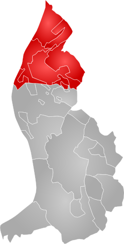
| Municipalities | 5 (Eschen, Gamprin, Mauren, Ruggell, Schellenberg) |
| Area | |
| • Total | 34.8 km2 (13.4 sq mi) |
| Population (2019) | |
| • Total | 13,986 |
| Time zone | UTC+1 (CET) |
| • Summer (DST) | UTC+2 (CEST) |
| Area code(s) | (+423) |

Unterland (German: Wahlkreis Unterland), meaning "lower land", is one of the two electoral districts of Liechtenstein.[1] The district's administrative seat is the town of Schellenberg, due to its historical existence as the Lordship of Schellenberg (German: Herrschaft Schellenberg). It has 10 seats in the Landtag.
Geography[]
The district is less populous than Oberland (the other district) and takes up between a fifth and a sixth of Liechtenstein's total area. It comprises five municipalities and three villages, for a total of eight settlements.[2]
| Municipality | Pop. (2014) | Area (km²) | Hamlets |
|---|---|---|---|
| 4,313 | 10.3 | Nendeln | |
| 1,657 | 6.1 | Bendern | |
| 4,189 | 7.5 | Schaanwald | |
| 2,146 | 7.4 | none | |
| 1,053 | 3.5 | Hinterschellenberg |
See also[]
- Oberland (electoral district)
- Landtag of Liechtenstein
- NUTS statistical regions of Liechtenstein
- Lists of electoral districts by nation
References[]
- ^ (in German) Politics and electoral districts of Liechtenstein
- ^ 1156141 Unterland on OpenStreetMap
External links[]
![]() Media related to Unterland at Wikimedia Commons
Media related to Unterland at Wikimedia Commons
| Authority control |
|
|---|
Categories:
- Electoral districts of Liechtenstein