Urayasu
Urayasu
浦安市 | |
|---|---|
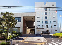 Urayasu City Hall | |
 Flag  Seal | |
 Location of Urayasu in Chiba Prefecture | |
 Urayasu | |
| Coordinates: 35°39′14.2″N 139°54′7.8″E / 35.653944°N 139.902167°ECoordinates: 35°39′14.2″N 139°54′7.8″E / 35.653944°N 139.902167°E | |
| Country | Japan |
| Region | Kantō |
| Prefecture | Chiba |
| First official history | 1157[citation needed] |
| City Settled | April 1, 1981 |
| Government | |
| • Mayor | Hideki Matsuzaki (since November 1998) |
| Area | |
| • Total | 17.30 km2 (6.68 sq mi) |
| Population (April 1, 2021) | |
| • Total | 170,091 |
| • Density | 9,800/km2 (25,000/sq mi) |
| Time zone | UTC+9 (Japan Standard Time) |
| -Tree | Ginkgo biloba |
| - Flower | Azalea |
| Phone number | 047-351-1111 |
| Address | 1-1-1 Nekozane, Urayasu-shi, Chiba-ken 279-8501 |
| Website | Official website |


Urayasu (浦安市, Urayasu-shi) is a city located in Chiba Prefecture, Japan. As of 1 November 2020, the city had an estimated population of 170,533 in 81,136 households and a population density of 9,900 inhabitants per square kilometre (26,000/sq mi).[1] The total area of the city is 17.30 square kilometres (6.68 sq mi). Urayasu is best known as the home of the Tokyo Disney Resort, which opened in April 1983,[2] and the headquarters of The Oriental Land Company.[3]
Geography[]
Urayasu is located in the northwestern part of Chiba Prefecture, about 20 kilometers from the prefectural capital at Chiba and within 10 to 20 kilometers from the center of Tokyo. It consists of a low-lying natural levee, a delta and a reclaimed land on the left bank of the mouth of the Edo River. The river runs along the western side of the city and separates it from the Edogawa ward of Tokyo.[4] There are two parts to Urayasu: the original fishing village on natural levee on both banks of the Sakai River, which is a tributary of the Edo River, and the newer reclaimed land portion which occupies about three-quarters of the city area, created since the 1960s. The new landfill area is called "Shin-Urayasu" (New-Urayasu), and has an "American" inspired layout, with a grid-like map of wide streets, large sidewalks, palm trees and parks. The buildings are tall, modern apartments, some having views on Tokyo Bay. Urayasu is one of the most sought after areas in the metropolitan area for young families to live.
Neighboring municipalities[]
Tokyo Metropolis
Climate[]
Urayasu has a Humid subtropical climate (Köppen Cfa) characterized by warm summers and cool winters with light to no snowfall. The average annual temperature in Urayasu is 15.6 °C. The average annual rainfall is 1435 mm with September as the wettest month. The temperatures are highest on average in August, at around 27.0 °C, and lowest in January, at around 6.2 °C.[5]
Demographics[]
Per Japanese census data,[6] the population of Urayasu has been steeply increasing over the past 40 years.
| Year | Pop. | ±% |
|---|---|---|
| 1920 | 9,146 | — |
| 1930 | 10,537 | +15.2% |
| 1940 | 12,116 | +15.0% |
| 1950 | 15,679 | +29.4% |
| 1960 | 16,847 | +7.4% |
| 1970 | 21,880 | +29.9% |
| 1980 | 64,673 | +195.6% |
| 1990 | 115,675 | +78.9% |
| 2000 | 132,894 | +14.9% |
| 2010 | 164,878 | +24.1% |
History[]
Early history[]
The area around Urayasu was tenryō territory within Shimōsa Province controlled directly by the Tokugawa shogunate during the Edo period. Urayasu served as an important fishing village for the Edo capitol.[2] Until the industrialization of the city it was a major center of production of nori, an edible seaweed, hamaguri, and asari clams.[4] All three are important elements of the traditional Japanese diet.
Modern history[]
After the Meiji Restoration in 1868 the area became part of Chiba Prefecture. Urayasu Village was created on April 1, 1889 under Higashikatsushika District with the establishment of the modern municipalities system. Urayasu became a town in September 1909. Many of the residents of Urayasu perished during the 1944 Bombing of Tokyo.[4]
Urayasu grew in the 1960s and 1970s with massive landfill projects along the shores of Tokyo Bay, public housing projects, and increasing infrastructure. Urayasu became part of the Keiyō Industrial Zone in this period, which spans from the city across the Tokyo Bay coast of Chiba Prefecture to Futtsu to the south.[4] An area of the Tokyo Bay near the town was reclaimed form the sea in 1960s called Maihama.[7] Fishing was abandoned in Urayasu in 1971 due to the industrialization of the city.[4]
Urayasu was elevated to city status on April 1, 1981.[8] Tokyo Disneyland opened in 1983 on 200 acres in Maihama.[7]
2011 Tōhoku earthquake and tsunami[]
Urayasu was greatly affected by the March 2011 Tōhoku earthquake and tsunami. The reclaimed land across most of northern Chiba Prefecture was damaged by soil liquefaction in the earthquake. Urayasu, with major areas of reclaimed land, had as much as 85% of the utility infrastructure, roads, buildings, and houses damaged or affected to some degree by soil liquefaction. The damage cost the city approximately ¥73.4 billion to repair.[9][10]
Government[]
Urayasu has a mayor-council form of government with a directly elected mayor and a unicameral city council of 21 members. Urayasu contributes two members to the Chiba Prefectural Assembly. In terms of national politics, the city is part of Chiba 5th district of the lower house of the Diet of Japan.
Economy[]

Urayasu is a regional commercial center and a bedroom community for nearby Chiba and Tokyo. The commuting rate to the central Tokyo is 49.0% per the 2015 interim census. The primary local employer in the city is The Oriental Land Company and businesses related to Tokyo Disney Resort.
Education[]
Universities[]
High schools[]
Public (operated by Chiba Prefectural Board of Education):
Private schools:
Primary and middle schools[]
Urayasu has 17 public elementary schools and nine public middle schools operated by the city government and two private middle schools.
Transportation[]
Railway[]
![]() JR East – Keiyō Line
JR East – Keiyō Line
- Maihama - Shin-Urayasu - Ichikawa-Shiohama
![]() Tokyo Metro - Tokyo Metro Tōzai Line
Tokyo Metro - Tokyo Metro Tōzai Line
![]() Maihama Resort Line - Disney Resort Line
Maihama Resort Line - Disney Resort Line
- Resort Gateway - Tokyo Disneyland - - Tokyo DisneySea - Resort Gateway
Highway[]
Sister City relations[]
 – Orlando, Florida, United States, since October 23, 1989
Noted people from Urayasu[]
- Keita Amemiya, Video game designer
- Shinnosuke Abe, professional baseball player
- Keiji Tamada, professional soccer player
- Momoko Abe, Model and Miss Universe Japan 2017
- Daisuke Hayakawa, professional baseball player
- Ichiko Aoba, folk singer and songwriter
References[]
- ^ "Urayasu city official statistics" (in Japanese). Japan.
- ^ Jump up to: a b "Urayasu". Encyclopedia of Japan. Tokyo: Shogakukan. 2012. Retrieved 16 May 2012.
- ^ "Summary." OLC Group. Retrieved on October 1, 2009.
- ^ Jump up to: a b c d e "Urayasu". Nihon Daihyakka Zensho (Nipponika) (in Japanese). Tokyo: Shogakukan. 2012. Archived from the original on 2007-08-25. Retrieved 2012-05-16.
- ^ Urayasu climate data
- ^ Urayasu population statistics
- ^ Jump up to: a b Shapiro, Margaret (December 16, 1989). "Unlikely Tokyo Bay Site Is a Holiday Hit : Disneyland: For millions of Japanese, Mickey Mouse and Space Mountain are a vacationer's dream". Los Angeles Times. Retrieved August 20, 2015.
- ^ 沿革と市域の変遷. Urayasu city official home page (in Japanese). 2015. Retrieved 26 February 2016.
- ^ Fukue, Natsuko, "Urayasu still dealing with liquefaction", Japan Times, 8 April 2011, p. 4.
- ^ Yomiuri Shimbun, "Liquefaction Damage Widespread", 10 April 2011.
External links[]
| Wikimedia Commons has media related to Urayasu, Chiba. |
- Official Website (in Japanese)
- Urayasu Tourism Website (in Japanese)
 Urayasu travel guide from Wikivoyage
| show Authority control |
|---|
- Urayasu, Chiba
- Cities in Chiba Prefecture
- Populated coastal places in Japan