Urucará
Urucará | |
|---|---|
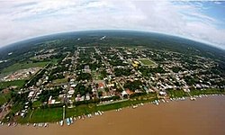 View of Urucará | |
 Seal | |
 Location of the municipality inside Amazonas | |
 Urucará Location in Brazil | |
| Coordinates: 2°32′9″S 57°45′36″W / 2.53583°S 57.76000°WCoordinates: 2°32′9″S 57°45′36″W / 2.53583°S 57.76000°W | |
| Country | |
| Region | North |
| State | |
| Population (2020) | |
| • Total | 16,130 |
| Time zone | UTC−4 (AMT) |

Urucará is a municipality in the Brazilian state of Amazonas. Its population was 16,130 (2020)[1] and its area is 27,905 km2.[2]
The municipality contains part of the 938,720 hectares (2,319,600 acres) Uatumã Biological Reserve, a strictly protected conservation unit created in 2002.[3]
References[]
Capital: Manaus | ||||||||||||||
| Mesoregion Centro Amazonense |
|  | ||||||||||||
| Mesoregion Norte Amazonense |
| |||||||||||||
| Mesoregion Sudoeste Amazonense |
| |||||||||||||
| Mesoregion Sul Amazonense |
| |||||||||||||
This article about a location in the Brazilian state of Amazonas is a stub. You can help Wikipedia by . |
Categories:
- Municipalities in Amazonas (Brazilian state)
- Amazonas (Brazilian state) geography stubs