Utah State Route 31
 | ||||
|---|---|---|---|---|
| Huntington Canyon Scenic Byway | ||||
 | ||||
| Route information | ||||
| Maintained by UDOT | ||||
| Length | 47.746 mi[1] (76.840 km) | |||
| Existed | 1915 as a state highway; 1927 as SR-31–present | |||
| Major junctions | ||||
| West end | ||||
| East end | ||||
| Highway system | ||||
| ||||
| ||||
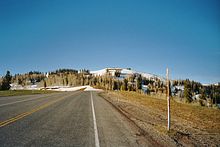
State Route 31 (SR-31) is a state highway in Sanpete and Emery Counties in the U.S. state of Utah. It runs for 47.746 miles (76.840 km) from US-89 at Fairview to SR-10 in Huntington. The highway has been designated as part of The Energy Loop, a National Scenic Byway.
Route description[]
SR-31 begins at an intersection with US-89 at Fairview and runs east northeast for approximately 10 miles (16 km), then turns southeast for the remainder of the route, terminating at an intersection with SR-10 at Huntington.[1]
Just off State Route 31, about 15 miles (24 km) west north-west of Huntington, is Crandall Canyon, location of the Crandall Canyon coal mine. On Monday, August 6, 2007, at 2:48 A.M., the mine collapsed, trapping and killing six workers inside. A second collapse on August 16, 2007, killed a Mine Safety and Health Administration investigator and two more miners, bringing the total to nine.[2]
History[]
The road from SR-32 (by 1926 US-89) in Fairview east to the Sanpete-Emery County line, near the present north end of Electric Lake, was added to the state highway system in 1915. It was extended southeast to SR-10 in Huntington in 1918,[3] and in 1927 the state legislature numbered the Fairview-Huntington highway as SR-31.[4] A major realignment was made in 1976, when Electric Lake was created and a new route was built to the west. The old route in Sanpete County became a county road, and is now part of SR-264, but the majority of the road in Emery County was beneath the lake and thus abandoned.[3]
Major intersections[]
| County | Location | mi[1] | km | Destinations | Notes |
|---|---|---|---|---|---|
| Sanpete | Fairview | 0.000 | 0.000 | Western terminus | |
| 0.085 | 0.137 | ||||
| | 8.576 | 13.802 | |||
| Emery | Huntington | 47.746 | 76.840 | Eastern terminus | |
| 1.000 mi = 1.609 km; 1.000 km = 0.621 mi | |||||
See also[]
References[]
- ^ a b c UDOT Highway Reference, SR-31
- ^ "Report on the August 6, 2007 Disaster at Crandall Canyon Mine" (PDF). United States Senate Health, Education, Labor and Pensions Committee.
- ^ a b Utah Department of Transportation, Highway Resolutions: "Route 31". (2.01 MB), updated October 2007, accessed May 2008
- ^ Utah State Legislature (1927). "Chapter 21: Designation of State Roads". Session Laws of Utah.
31. From Fairview southeasterly to Huntington.
External links[]
Route map:

| ( • help)
|
![]() Media related to Utah State Route 31 at Wikimedia Commons
Media related to Utah State Route 31 at Wikimedia Commons
- State highways in Utah
- Utah Scenic Byways
- Utah State Routes in Sanpete County, Utah
- Utah State Routes in Emery County, Utah