Uva Province
Uva Province
ඌව පළාත ஊவா மாகாணம் | |
|---|---|
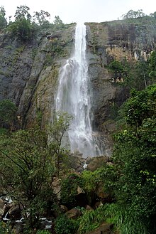
 View from Haputale-Beragala gap | |
 Location within Sri Lanka | |
| Coordinates: 6°35′24″N 81°01′48″E / 6.59000°N 81.03000°ECoordinates: 6°35′24″N 81°01′48″E / 6.59000°N 81.03000°E | |
| Country | Sri Lanka |
| Created | 1886 |
| Admitted | 14 November 1987 |
| Capital | Badulla |
| Largest City | Badulla |
| Government | |
| • Governor | Raja Collure |
| Area | |
| • Total | 8,500 km2 (3,300 sq mi) |
| Area rank | 4th (12.92% of total area) |
| Population (2011 census) | |
| • Total | 1,259,800 |
| • Rank | 7th (6.3% of total pop.) |
| • Density | 150/km2 (380/sq mi) |
| Gross Regional Product (2010)[1] | |
| • Total | Rs 220 billion |
| • Rank | 8th (4.6% of total) |
| Time zone | UTC+05:30 (Sri Lanka) |
| ISO 3166 code | LK-8 |
| Vehicle registration | UP |
| Official Languages | Sinhalese, Tamil |
| Symbols | Gurulu raaja (Rhynchostylis retusa) |
| Website | www |


Uva Province (Sinhala: ඌව පළාත Uva Paḷāta, Tamil: ஊவா மாகாணம் Uvā Mākāṇam) is Sri Lanka's second least populated province, with 1,259,880 people, created in 1896. It consists of two districts: Badulla and Moneragala. The provincial capital is Badulla. Uva is bordered by Eastern, Southern, Sabaragamuwa and Central provinces. Its major tourist attractions are Dunhinda falls, Diyaluma Falls, Rawana Falls, the Yala National Park (lying partly in the Southern and Eastern Provinces) and Gal Oya National Park (lying partly in the Eastern Province). The Gal Oya hills and the Central mountains are the main uplands, while the Mahaweli (Sinhalese: great-sandy) and Menik (Sinhalese: gemstone) rivers and the huge Senanayake Samudraya and Maduru Oya Reservoirs are the major waterways.
History[]
The provincial history records an 1818 uprising (the Third Kandyan War) against the British colonial government which had been controlling the formally independent Udarata (Sinhalese: Up-Country), of which Uva was a province. The uprising was led by Keppetipola Disawe - a rebel leader that the Sinhalese celebrate even today - who was sent initially by the British Government to stop the uprising.[citation needed] The rebels captured Matale and Kandy before Keppetipola fell ill and was captured - and beheaded by the British. His skull was abnormal - as it was wider than usual - and was sent to Britain for analysis. It was returned to Sri Lanka after independence, and now rests in the Kandyan Museum.[2]
The rebellion, which soon developed into a guerrilla war of the kind the Kandyans had fought against European powers for centuries, was centred on the Kandyan nobility and their unhappiness with developments under British rule since 1815. However it was the last uprising of this kind and in Uva Province, a scorched earth policy was pursued, and all males between 15 and 60 years were driven out, exiled or killed. The British Crown annexed the Kingdom of Kandy to British Ceylon in 1817.[3][4]
Administrative divisions[]
Districts[]

Uva is divided into 2 districts:
- Badulla District 2,861 km2 (1,105 sq mi)
- Moneragala District 5,639 km2 (2,177 sq mi)
Divisional secretariats[]
The districts of the Sri Lanka are divided into administrative sub-units known as divisional secretariats. These were originally based on the feudal counties, the korales[what language is this?] and ratas[what language is this?]. They were formerly known as "D.R.O. Divisions" after the Divisional Revenue Officer. Later the D.R.O.s became Assistant Government Agents and the Divisions were known as "A.G.A. Divisions". Currently, the Divisions are administered by a Divisional Secretary and are known as "D.S. Divisions".
There are 26 divisional secretariats divided in Uva Province, which are listed below, by district. There are 15 in Badulla District and 11 in Moneragala District.
Major cities and towns[]


Mountains[]
Uva's symbolic mountain is Namunukula which stands tallest among the mountain range surrounding the Badulla town. There are views of the Welimada basin, Katharagama and Hambantota beach from Namunukula peak on a clear day.
Haputale mountain range has its tallest, peak Kirigalpottha. Haputale-Beragala gap gives a view of the Southern and Sabaragamuwa provinces on a clear day.
See also[]
References[]
- ^ ":.News Line : North, East record highest GDP growth rate". Archived from the original on 20 June 2012. Retrieved 1 February 2014.
- ^ Müller, J. B. (6 November 2010). "Anglophiles, Eurocentric arrogance and Reality". The Island.
- ^ Müller, J. B. (6 November 2010). "Anglophiles, Eurocentric arrogance and Reality". The Island.
- ^ Keerthisinghe, Lakshman I. (2013). "The British duplicity in protecting human rights in Sri Lanka". Daily Mirror. Archived from the original on 21 October 2013. Retrieved 21 October 2013.
External links[]
| Wikimedia Commons has media related to Uva Province. |
| show Places adjacent to Uva Province |
|---|


| show Authority control |
|---|
- Uva Province
- States and territories established in 1896
- Provinces of Sri Lanka