Vārkava Parish
Vārkava Parish | |
|---|---|
parish of Latvia | |
 | |
| Country | Latvia |
| Area | |
| • Total | 78.68 km2 (30.38 sq mi) |
| • Land | 77.15 km2 (29.79 sq mi) |
| • Water | 1.53 km2 (0.59 sq mi) |
| Population (1 January 2021)[2] | |
| • Total | 508 |
| • Density | 6.5/km2 (17/sq mi) |

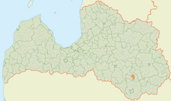
Vārkava Parish (Latvian: Vārkavas pagasts) is an administrative unit of Preiļi Municipality in the Latgale region of Latvia.
Towns, villages and settlements of Vārkava Parish[]
The central village in the parish is . The village, parish, and surrounding municipality are also called Vorkova in the Latgalian language.
This Latgale location article is a stub. You can help Wikipedia by . |
- ^ https://data.stat.gov.lv/pxweb/lv/OSP_PUB/START__ENV__DR__DRT/DRT010/; Central Statistical Bureau of Latvia; retrieved: 26 February 2021.
- ^ https://data.stat.gov.lv/pxweb/lv/OSP_PUB/START__POP__IR__IRS/IRD060/; Central Statistical Bureau of Latvia; retrieved: 15 June 2021.
Categories:
- Parishes of Latvia
- Preiļi Municipality
- Latgale
- Latgale geography stubs