Vadakste
| Vadakste | |
|---|---|
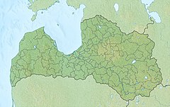
 River is on the Lithuanian-Latvian border. | |
 | |
| Native name |
|
| Location | |
| Country | |
| Physical characteristics | |
| Source | |
| • coordinates | 56°29′45″N 22°55′43″E / 56.49583°N 22.92861°E |
| • elevation | 43 m (141 ft) |
| Mouth | |
• location | Venta River |
• coordinates | 56°24′43″N 22°13′3″E / 56.41194°N 22.21750°ECoordinates: 56°24′43″N 22°13′3″E / 56.41194°N 22.21750°E |
| Length | 82.2 km (51.1 mi) |
| Basin size | 1,230 km2 (470 sq mi) |
| Discharge | |
| • average | 95 m3/s (3,400 cu ft/s) |
| Basin features | |
| Tributaries | |
| • left | , Agluona, |
| • right | Līgotne, Avīkne, Benaišu strauts, Burbuļ strauts, Alkšņupe, , Suste, Rīku strauts, Pestīle |

Vadakste (Lithuanian: Vadakstis) is a river in the southern Latvia and northern Lithuania. It is a right tributary of the Venta River. The length is 82.2 km (51.1 mi), of which over 55 km (34 mi) follow the Latvia–Lithuania border. The catchment area is 1,230 km2 (470 sq mi).[1] It originates near the city Auce, Latvia. It flows first in a southwest, and then in a westerly direction. It begins to flow along the border between Latvia and Lithuania from the village of Vegeriai. It flows into Venta at 184.2 km (114.5 mi) from its mouth, in the village of Griežė, 2 km (1.2 mi) northwest of Leckava.
The main tributaries: , , Agluona and Avīkne. The average river slope is 73 cm/km.[2]
References[]
| Wikimedia Commons has media related to Vadakstis. |
- ^ "Vadakstis, Vadakste (Ventos baseinas, Ventos intakas)". www.upese.lt. Lietuvos upės
- ^ Vadakstis. Tarybų Lietuvos enciklopedija, T. 4 (Simno-Žvorūnė). - Vilnius: Vyriausioji enciklopedijų redakcija, 1988. 404 psl.
Categories:
- International rivers of Europe
- Border rivers
- Rivers of Latvia
- Rivers of Lithuania
- Latvia–Lithuania border
- Venta River basin
- Europe river stubs
- Latvia geography stubs
- Lithuania river stubs