Vaux, Vienne
Vaux | |
|---|---|
Part of Valence-en-Poitou | |
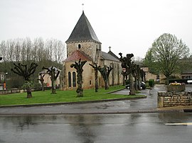 The church in Vaux | |
show Location of Vaux | |
 Vaux | |
| Coordinates: 46°17′54″N 0°13′19″E / 46.2983°N 0.2219°ECoordinates: 46°17′54″N 0°13′19″E / 46.2983°N 0.2219°E | |
| Country | France |
| Region | Nouvelle-Aquitaine |
| Department | Vienne |
| Arrondissement | Montmorillon |
| Canton | Lusignan |
| Commune | Valence-en-Poitou |
| Area 1 | 25.84 km2 (9.98 sq mi) |
| Population (2017)[1] | 797 |
| • Density | 31/km2 (80/sq mi) |
| Time zone | UTC+01:00 (CET) |
| • Summer (DST) | UTC+02:00 (CEST) |
| Postal code | 86700 |
| Elevation | 106–151 m (348–495 ft) (avg. 120 m or 390 ft) |
| 1 French Land Register data, which excludes lakes, ponds, glaciers > 1 km2 (0.386 sq mi or 247 acres) and river estuaries. | |


Vaux or Vaux-en-Couhé is a former commune in the Vienne department in the Nouvelle-Aquitaine region in western France. On 1 January 2019, it was merged into the new commune Valence-en-Poitou.[2]
Its inhabitants are called the Valois and Valoises. It covered 25.8 km ² and had 797 inhabitants in 2017.[1] Surrounded by the communes of Chatillon, Romagna and Ceaux-en-Couhé, Vaux is located 33 km southwest of Poitiers, the largest city nearby.
References[]
- ^ Jump up to: a b Téléchargement du fichier d'ensemble des populations légales en 2017, INSEE
- ^ Arrêté préfectoral 22 November 2018 (in French)
External links[]
| Wikimedia Commons has media related to Vaux (Vienne). |
This Vienne geographical article is a stub. You can help Wikipedia by . |
Categories:
- Former communes of Vienne
- Vienne geography stubs