Vestfjorden
| Vestfjord | |
|---|---|
 Map of the fjord | |
 Vestfjorden Location of the fjord | |
| Location | Nordland county, Norway |
| Coordinates | 68°03′N 14°46′E / 68.050°N 14.767°ECoordinates: 68°03′N 14°46′E / 68.050°N 14.767°E |
| Type | Fjord |
| Native name | Vestfjorden (Bokmål) |
| Basin countries | Norway |
| Max. length | 155 kilometres (96 mi) |
| Max. width | 80 kilometres (50 mi) |


Vestfjorden is a 155-kilometre (96 mi) long fjord or oceanic sea in Nordland county, Norway.[1][2]
The name literally means "the west fjord", although it is called a fjord, it could best be described as a firth or an open bight of sea. The "fjord" lies between the Lofoten archipelago and the Salten district of mainland Norway. The term fjord (from the old Norse fjördr meaning firth or inlet) is used more generally for bodies of water in the western Scandinavian languages than the more narrow usage assigned in English.[3][4]
The Vestfjord flows from the area near the town of Narvik to the west and southwest. The mouth of the Vestfjord is about 80 kilometres (50 mi) wide, roughly running from the mainland town of Bodø to the islands of Røstlandet and Værøya to the northwest of Bodø.[1]
The Vestfjord is famous for its cod fishery, which was exploited back to the early medieval period. More recently, the winter invasion of Orcas in the inner parts of Vestfjord has become a tourist attraction. Strong winds with heavy seas are not uncommon in Vestfjord in winter.[1]
Media gallery[]
Vågakallen mountain and the Lofoten wall, view towards west

Vestfjord seen from a mountain in Steigen, with the southern part of the Lofoten wall visible on the right

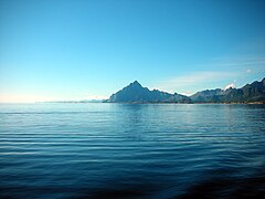
A calm summer day on Vestfjord


References[]
- ^ a b c Thorsnæs, Geir, ed. (2018-11-18). "Vestfjorden". Store norske leksikon (in Norwegian). Kunnskapsforlaget. Retrieved 2018-11-20.
- ^ Sømme, Axel, ed. (1960). The Geography of Norden. London: Heinemann.
- ^ Soëga, Geir T. (1910). A Concise Dictionary of Old Icelandic. Clarendon Press.
- ^ Barnes, Michael (1999). A New Introduction to Old Norse. London: University College. ISBN 9780903521451.
This Nordland location article is a stub. You can help Wikipedia by . |
- Fjords of Nordland
- Lofoten
- Bights (geography)
- Nordland geography stubs
- Norway fjord stubs