Vidul Glacier
| Vidul Glacier | |
|---|---|
 Location of Sentinel Range in Western Antarctica. | |
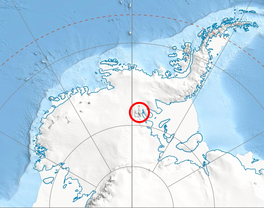
 Location of Vidul Glacier in Antarctica | |
| Location | Sentinel Range |
| Coordinates | 77°48′10″S 86°10′40″W / 77.80278°S 86.17778°W |
| Length | 4 nmi (7 km; 5 mi) |
| Width | 0.7 nmi (1 km; 1 mi) |
| Thickness | unknown |
| Status | unknown |


Vidul Glacier (Bulgarian: ледник Видул, romanized: lednik Vidul, IPA: [ˈlɛdniɡ ˈvidoɫ]) is the 7.5 km long and 1.4 km wide glacier on the east side of the main crest of northern Sentinel Range in Ellsworth Mountains, Antarctica. It is situated northwest of Skaklya Glacier and southwest of the middle course of Newcomer Glacier. The glacier drains the north slopes of Mount Reimer and the east slopes of Mount Dawson, flows northwards and joins Newcomer Glacier west of Mount Warren in Gromshin Heights.
The glacier is named after the Bulgarian rebel leader Vidul Voyvoda (Vidul Vidulov, 1777-1833).
Location[]
Vidul Glacier is centred at 77°48′10″S 86°10′40″W / 77.80278°S 86.17778°WCoordinates: 77°48′10″S 86°10′40″W / 77.80278°S 86.17778°W. US mapping in 1961.
See also[]
- List of glaciers in the Antarctic
- Glaciology
Maps[]
- Newcomer Glacier. Scale 1:250 000 topographic map. Reston, Virginia: US Geological Survey, 1961.
- Antarctic Digital Database (ADD). Scale 1:250000 topographic map of Antarctica. Scientific Committee on Antarctic Research (SCAR). Since 1993, regularly updated.
References[]
- Vidul Glacier SCAR Composite Gazetteer of Antarctica
- Bulgarian Antarctic Gazetteer Antarctic Place-names Commission (Bulgarian)
- Basic data (English)
External links[]
- Vidul Glacier. Copernix satellite image
This article includes information from the Antarctic Place-names Commission of Bulgaria which is used with permission.
This article about a glacier in Ellsworth Land is a stub. You can help Wikipedia by . |
- Glaciers of Ellsworth Land
- Bulgaria and the Antarctic
- Ellsworth Land glacier stubs