Viesīte Parish
Viesīte Parish | |
|---|---|
parish of Latvia | |
 | |
| Country | Latvia |
| Area | |
| • Total | 311.98 km2 (120.46 sq mi) |
| • Land | 302.09 km2 (116.64 sq mi) |
| • Water | 9.89 km2 (3.82 sq mi) |
| Population (1 January 2021)[2] | |
| • Total | 598 |
| • Density | 1.9/km2 (5.0/sq mi) |
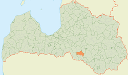
Viesīte Parish (Latvian: Viesītes pagasts) is an administrative unit of Jēkabpils Municipality in the Selonia region of Latvia. It was created in 2010 from the countryside territory of Viesīte town.[3] At the beginning of 2014, the population of the parish was 704.[4]
Towns, villages and settlements of Viesīte parish[]
- Eķengrāve
- Jodeļi
- Vārnava
- Viesīte - parish administrative center
References[]
| Wikimedia Commons has media related to Viesīte parish. |
- ^ https://data.stat.gov.lv/pxweb/lv/OSP_PUB/START__ENV__DR__DRT/DRT010/; Central Statistical Bureau of Latvia; retrieved: 26 February 2021.
- ^ https://data.stat.gov.lv/pxweb/lv/OSP_PUB/START__POP__IR__IRS/IRD060/; Central Statistical Bureau of Latvia; retrieved: 15 June 2021.
- ^ "Grozījumi Administratīvo teritoriju un apdzīvoto vietu likumā" [Amendments to the Administrative territories and settlements law]. Latvijas Vēstnesis (in Latvian). 10 February 2010. Retrieved 25 September 2014.
- ^ "Latvijas iedzivotaju skaits pašvaldibas" [Latvian population by municipality] (PDF). Pilsonības un migrācijas lietu pārvalde [Office of Citizenship and Migration Affairs] (in Latvian). 13 February 2014. Retrieved 28 September 2014.
Coordinates: 56°21′58″N 25°31′36″E / 56.36611°N 25.52667°E
This Latvian location article is a stub. You can help Wikipedia by . |
Categories:
- Parishes of Latvia
- Jēkabpils Municipality
- Selonia
- Latvia geography stubs