Virginia State Route 48
 | ||||
|---|---|---|---|---|
| Route information | ||||
| Maintained by NPS and VDOT | ||||
| Length | 321.2 mi (516.9 km) | |||
| Existed | July 1935[1]–present | |||
| Highway system | ||||
| ||||
State Route 48 (SR 48) is the unsigned designation for the Blue Ridge Parkway and Skyline Drive from the North Carolina state line north to U.S. Route 340 (US 340) near Front Royal.[2] Most of the road is maintained by the National Park Service, though the portion which is concurrent with SR 43 is maintained by the Virginia Department of Transportation (VDOT).
Other Route 48s[]
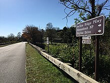
The junction of the Blue Ridge Parkway and Skyline Drive (SR 48) at Rockfish Gap
The following highways in Virginia have also been known as State Route 48:
 State Route 48, 1928 to the mid-1930s, now part of SR 40.
 U.S. Route 48, early 2000s to the present, concurrent with the westernmost 14 miles (23 km) of SR 55.
Major intersections[]
| County | Location | mi | km | Destinations | Notes | |
|---|---|---|---|---|---|---|
| Warren | | 0.0 | 0.0 | Northern terminus | ||
| Page | Thornton Gap | 31.5 | 50.7 | Thornton Gap Entrance Station, interchange | ||
| Rockingham | Swift Run Gap | 65.5 | 105.4 | Swift Run Gap Entrance Station, interchange | ||
| Augusta | Rockfish Gap | 105.5 | 169.8 | South end of Skyline Drive and north end of Blue Ridge Parkway; One-quadrant interchange; I-64 exit 99; mileposts reset to zero here | ||
| 13.7 | 22.0 | |||||
| Nelson | | 16.0 | 25.7 | Unpaved road | ||
| | 16.1 | 25.9 | ||||
| 27.1 | 43.6 | One-quadrant interchange | ||||
| Rockbridge | 45.5 | 73.2 | One-quadrant interchange | |||
| Amherst | 61.3 | 98.7 | One-quadrant interchange | |||
| Bedford | | 63.9 | 102.8 | One-quadrant interchange | ||
| Peaks of Otter | 85.9 | 138.2 | North end of SR 43 overlap; north end of VDOT maintenance of SR 43 (southern segment) | |||
| Botetourt | 89.0 | 143.2 | ||||
| 90.9 | 146.3 | Two-quadrant interchange; south end of SR 43 overlap; south end of VDOT maintenance of SR 43 (northern segment) | ||||
| | 105.9 | 170.4 | Two-quadrant interchange | |||
| Roanoke | | 112.3 | 180.7 | Two-quadrant interchange | ||
| | 115.2 | 185.4 | , Virginia's Explore Park () | |||
| | 120.5 | 193.9 | & Zoo, Historic Roanoke Star, Downtown Roanoke () | |||
| | 121.4 | 195.4 | Two-quadrant interchange | |||
| 136.0 | 218.9 | Connector road | ||||
| Floyd | | 159.3 | 256.4 | Former SR 109 | ||
| 165.1 | 265.7 | One-quadrant interchange | ||||
| | 174.0 | 280.0 | former SR 102 north | |||
| | 174.1 | 280.2 | former SR 102 south | |||
| | 174.2 | 280.3 | ||||
| Patrick | Meadows of Dan | 177.7 | 286.0 | Parkway and US 58 grade-separated; two-quadrant interchange with US 58 Bus. | ||
| Patrick–Carroll county line | 192.1 | 309.2 | ||||
| Carroll | | 199.0 | 320.3 | |||
| | 199.2 | 320.6 | ||||
| Fancy Gap | 199.4 | 320.9 | Two-quadrant interchange | |||
| Grayson | 215.7 | 347.1 | One-quadrant interchange | |||
| | North Carolina state line; southern terminus | |||||
1.000 mi = 1.609 km; 1.000 km = 0.621 mi
| ||||||
References[]
- ^ "Some Highways to Receive New Route Numbers". The Danville Bee. January 4, 1935. p. 3. Retrieved January 21, 2020 – via Newspapers.com.

- ^ "2016 Traffic Data". Virginia Department of Transportation. 2016. Retrieved November 24, 2017.
External links[]
 Media related to Virginia State Route 48 at Wikimedia Commons
Categories:
- State highways in Virginia
- Transportation in Albemarle County, Virginia
- Transportation in Amherst County, Virginia
- Transportation in Augusta County, Virginia
- Transportation in Bedford County, Virginia
- Transportation in Botetourt County, Virginia
- Transportation in Carroll County, Virginia
- Transportation in Floyd County, Virginia
- Transportation in Franklin County, Virginia
- Transportation in Grayson County, Virginia
- Transportation in Greene County, Virginia
- Transportation in Madison County, Virginia
- Transportation in Nelson County, Virginia
- Transportation in Page County, Virginia
- Transportation in Patrick County, Virginia
- Transportation in Rappahannock County, Virginia
- Transportation in Roanoke County, Virginia
- Transportation in Roanoke, Virginia
- Transportation in Rockbridge County, Virginia
- Transportation in Rockingham County, Virginia
- Transportation in Warren County, Virginia