Vogtei, Thuringia
Vogtei | |
|---|---|
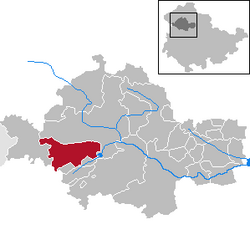
show Location of Vogtei within Unstrut-Hainich-Kreis district | |
 Vogtei | |
| Coordinates: 51°9′25″N 10°25′40″E / 51.15694°N 10.42778°ECoordinates: 51°9′25″N 10°25′40″E / 51.15694°N 10.42778°E | |
| Country | Germany |
| State | Thuringia |
| District | Unstrut-Hainich-Kreis |
| Area | |
| • Total | 49.51 km2 (19.12 sq mi) |
| Elevation | 227 m (745 ft) |
| Population (2020-12-31)[1] | |
| • Total | 4,323 |
| • Density | 87/km2 (230/sq mi) |
| Time zone | UTC+01:00 (CET) |
| • Summer (DST) | UTC+02:00 (CEST) |
| Postal codes | 99986 |
| Dialling codes | 03601 |
| Vehicle registration | UH |


Vogtei is a municipality in the Unstrut-Hainich-Kreis district of Thuringia, Germany. It was formed on 31 December 2012 by the merger of the former Vogtei Dorla consists of Langula, Niederdorla and Oberdorla. The closest city and the only one that it borders, is Mühlhausen northerly. Hainich National Park is situated westerly.
Geographical center[]
The widely accepted geographical center of Germany lies in Vogtei, more specifically in its Niederdorla section, where there is a plaque at 51°9′48.15″N 10°26′51.66″E / 51.1633750°N 10.4476833°E with the coordinates as calculated by technical experts.
See also[]
References[]
| show Towns and municipalities in Unstrut-Hainich-Kreis |
|---|
| Authority control |
|---|
This Unstrut-Hainich-Kreis location article is a stub. You can help Wikipedia by . |
Categories:
- Municipalities in Thuringia
- Unstrut-Hainich-Kreis
- Province of Saxony
- Bezirk Erfurt
- Thuringia geography stubs