Voivodeship road 430 (Poland)
 | ||||
|---|---|---|---|---|
| Droga wojewódzka nr 430 | ||||
 | ||||
| Route information | ||||
| Maintained by Wielkopolski Zarząd Dróg Wojewódzkich, Zarząd Dróg Miejskich w Poznaniu | ||||
| Length | 25 km (16 mi) | |||
| Major junctions | ||||
| From | Poznań | |||
| To | Mosina | |||
| Location | ||||
| Regions | Greater Poland Voivodeship | |||
| Major cities | Poznań | |||
| Highway system | ||||
| ||||
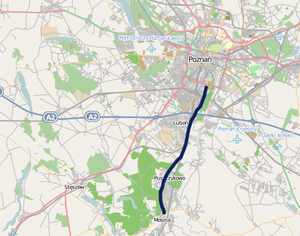
Voivodeship road 430 (Polish: Droga wojewódzka nr 430, abbreviated DW 430) is a route in the Polish voivodeship roads network. It runs through the Greater Poland Voivodeship (Poznań County), leading from Poznań, through Luboń and Puszczykowo to Mosina where it meets .
Major cities and towns along the route[]
- Poznań (motorway A2, national road 5, , , )
- Luboń
- Puszczykowo
- Mosina (Voivodeship road 431)
Route plan[]
This article contains a bulleted list or table of intersections which should be presented in a properly formatted junction table. (November 2021) |
| km | Icon | Name | Crossed roads |
|---|---|---|---|
| x | Mosina | Mocka Street | |
| x | Puszczykowo | Dworcowa Street | |
| x | Puszczykowo | Poznańska Street | |
| x | Łęczyca | Local road | |
| x | Luboń | Kręta Street | |
| x | Level crossing in Luboń, railway № 271 Poznań — Wrocław | — | |
| x | Luboń | Powstańców Wielkopolskich Street | |
| x | Luboń | Dębiecka Street | |
| x | Poznań – Luboń interchange (formerly "Dębina") | ||
| x | Poznań | 28 czerwca 1956 Street | |
| x | Poznań – Filling station (Shell) | — | |
| x | Poznań | Czechosłowacka Street | |
| x | Short dual carriageway road stretch under railway bridge | — | |
| x | Poznań | Piastowska Street | |
| x | Poznań | Wspólna Street | |
| x | Poznań – Dolna Wilda interchange | ||
| x | |||
| x | |||
| x | |||
| x |
Coordinates: 52°15′13″N 16°51′01″E / 52.253743°N 16.850272°E

This Polish road or road transport-related article is a stub. You can help Wikipedia by . |
Categories:
- Voivodeship roads
- Poland road stubs