Vouga River
This article does not cite any sources. (December 2007) |
| Vouga | |
|---|---|
 | |
| Location | |
| Country | Portugal |
| Physical characteristics | |
| Source | Chafariz da Lapa |
| • location | Serra da Lapa, Sernancelhe, Viseu, Portugal |
| Mouth | |
• location | Atlantic Ocean at Aveiro, Portugal |
| Length | 148 km (92 mi) |
| Basin size | 3,635 km2 (1,403 sq mi) |
| Basin features | |
| Tributaries | |
| • right | Caima |
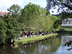
Vouga River (Portuguese pronunciation: [ˈvo(w)ɡɐ]) is a river in the Centro Region of Portugal. The source of the Vouga is the , at an elevation of 864 metres (2,835 ft), in the parish of Quintela, municipality of Sernancelhe, Viseu District. The course of the river ends in the Atlantic Ocean, in the form of a ria, the Ria de Aveiro.
Tributaries[]
Environment[]
Cacia pulp and paper mill effluent, one of the major polluting sources of the Vouga River and Aveiro Lagoon, is discharged into the Aveiro coastal area. The area has an unpleasant smell due to the effluent.
| hide Authority control | |
|---|---|
| General |
|
| National libraries | |
Coordinates: 40°40′59″N 8°40′01″W / 40.683°N 8.667°W

This Viseu location article is a stub. You can help Wikipedia by . |
This Aveiro location article is a stub. You can help Wikipedia by . |
Categories:
- Rivers of Portugal
- Natura 2000 in Portugal
- Portugal geography stubs
- Aveiro geography stubs
- Portugal river stubs