Waban station
Waban | |||||||||||
|---|---|---|---|---|---|---|---|---|---|---|---|
An outbound train at Waban station in September 2015 | |||||||||||
| Location | Beacon Street and Waban Square Newton, Massachusetts | ||||||||||
| Coordinates | 42°19′33″N 71°13′50″W / 42.32583°N 71.23056°WCoordinates: 42°19′33″N 71°13′50″W / 42.32583°N 71.23056°W | ||||||||||
| Owned by | Massachusetts Bay Transportation Authority | ||||||||||
| Line(s) | Highland branch | ||||||||||
| Platforms | 2 side platforms | ||||||||||
| Tracks | 2 | ||||||||||
| Construction | |||||||||||
| Parking | 74 spaces ($6.00 fee) | ||||||||||
| Bicycle facilities | 12 spaces | ||||||||||
| History | |||||||||||
| Opened | July 4, 1959[1] | ||||||||||
| Passengers | |||||||||||
| 2011 daily | 545[2] | ||||||||||
| Services | |||||||||||
| |||||||||||
| |||||||||||

Waban is a surface-level light rail station on the Massachusetts Bay Transportation Authority's Green Line D branch, located just south of Beacon Street at Waban Square in the Waban section of Newton, Massachusetts. The station is located below grade; access to both platforms is via Wyman Street on the outbound side of the tracks or a stairway from Beacon Street. Waban is not accessible.
History[]
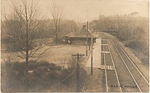
Waban formerly boasted an H.H. Richardson-designed train station, like those still standing in Newton Highlands and Newton Centre. The original station was completed in August 1886 as part of the Boston and Albany Railroad's Highland branch and was one of the last stations designed by Richardson before his death in April 1886.[3]
Waban closed along with the rest of the Highland branch commuter rail line in 1958 and reopened on July 4, 1959 as part of the light rail D branch. The H. H. Richardson station was demolished in order to build a 57-space parking lot.
The station has two MBTA ticket machines for reloading stored-value CharlieCards and buying CharlieTickets, as well one fare validation machine. All three are enclosed in a heated passenger shed near the center of the inbound platform.
On May 28, 2008, two westbound Green Line trains collided between Waban and Woodland, killing one person.
In 2019, the MBTA indicated that the four remaining non-accessible stops on the D branch were "Tier I" accessibility priorities.[4] A preliminary design contract for accessibility modifications at the four stations was issued in February 2021.[5] As of April 2021, final design is expected to be complete in early 2022, with construction from mid-2022 to mid-2023.[6]
References[]
- ^ Belcher, Jonathan. "Changes to Transit Service in the MBTA district" (PDF). Boston Street Railway Association.
- ^ "Ridership and Service Statistics" (PDF) (14th ed.). Massachusetts Bay Transportation Authority. 2014.
- ^ Ochsner, Jeffrey Karl (June 1988). "Architecture for the Boston & Albany Railroad: 1881-1894". Journal of the Society of Architectural Historians. 47 (2): 109–131. doi:10.2307/990324. JSTOR 990324.
- ^ "Preview of 2019 Recommendations: Presentation to the FMCB" (PDF). Plan for Accessible Transit Infrastructure (PATI). Massachusetts Bay Transportation Authority. April 1, 2019. p. 12.
- ^ "D Branch Station Accessibility Improvements". Massachusetts Bay Transportation Authority. Archived from the original on March 19, 2021.
- ^ "D Branch Station Accessibility Improvements: Waban, Eliot, Chestnut Hill, Beaconsfield: Virtual Public Meeting" (PDF). Massachusetts Bay Transportation Authority. April 29, 2021.
External links[]
| Wikimedia Commons has media related to Waban station. |
This article relating to the Massachusetts Bay Transportation Authority is a stub. You can help Wikipedia by . |
This tram-, streetcar-, or light rail-related article is a stub. You can help Wikipedia by . |
This Massachusetts train station–related article is a stub. You can help Wikipedia by . |
- Green Line (MBTA) stations
- Railway stations in Middlesex County, Massachusetts
- Former Boston and Albany Railroad stations
- Railway stations in the United States opened in 1959
- Massachusetts Bay Transportation Authority stubs
- Tram stubs
- Massachusetts railway station stubs