Wald, Baden-Württemberg
show This article may be expanded with text translated from the corresponding article in German. (February 2009) Click [show] for important translation instructions. |
Wald | |
|---|---|
 Wald monastery | |
 Coat of arms | |
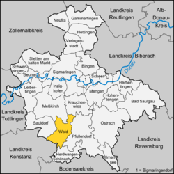
show Location of Wald within Sigmaringen district | |
 Wald | |
| Coordinates: 47°56′12″N 9°10′24″E / 47.93667°N 9.17333°ECoordinates: 47°56′12″N 9°10′24″E / 47.93667°N 9.17333°E | |
| Country | Germany |
| State | Baden-Württemberg |
| Admin. region | Tübingen |
| District | Sigmaringen |
| Government | |
| • Mayor | Werner Müller |
| Area | |
| • Total | 43.87 km2 (16.94 sq mi) |
| Elevation | 657 m (2,156 ft) |
| Population (2020-12-31)[1] | |
| • Total | 2,687 |
| • Density | 61/km2 (160/sq mi) |
| Time zone | UTC+01:00 (CET) |
| • Summer (DST) | UTC+02:00 (CEST) |
| Postal codes | 88639 |
| Dialling codes | 07578 |
| Vehicle registration | SIG |
| Website | www.wald-hohenzollern.de |


Wald is a municipality in the district of Sigmaringen in Baden-Württemberg in Germany.
| Coat of arms | District | Inhabitants (2010) | Size |
|---|---|---|---|
| Wald (main locality) | 843 | 827,47 ha | |
| 97 | 178,66 ha | ||
| 201 | 348,73 ha | ||
| 105 | 334,66 ha | ||
| 67 | 217,61 ha | ||
| 83 | 203,61 ha | ||
| Rothenlachen | 38 | 217,26 ha | |
| 174 | 643,29 ha | ||
| 340 | 575,80 ha | ||
| 639 | 839,57 ha |

Well in the Wald monastery
Girl School[]
Kloster Wald[]
The students get to know the different workshops in a trial week in class 8. They can decide for one of the artisanal trainings according to their interests and abilities. The training starts parallel to school in class 9 on one afternoon per week until the graduation. After that, the training continues in theory and practice full-time until ensuing spring.[2]
Staate journeyman's examinations[]
body under public law, the proper Chamber of Crafts.[3]
References[]
- ^ "Bevölkerung nach Nationalität und Geschlecht am 31. Dezember 2020". Statistisches Landesamt Baden-Württemberg (in German). June 2021.
- ^ Wald
- ^ journeyman
| show Towns and municipalities in Sigmaringen (district) |
|---|
| show Authority control |
|---|
This Sigmaringen district location article is a stub. You can help Wikipedia by . |
Categories:
- Municipalities in Baden-Württemberg
- Sigmaringen (district)
- Province of Hohenzollern
- Tübingen region geography stubs