Walwyn's Castle
Walwyn's Castle
| |
|---|---|
 | |
 Walwyn's Castle Location within Pembrokeshire | |
| Population | 361 |
| OS grid reference | SM 8727 1121 |
| • Cardiff | 84.1 mi (135.3 km) |
| • London | 213.2 mi (343.1 km) |
| Community |
|
| Principal area | |
| Country | Wales |
| Sovereign state | United Kingdom |
| Post town | Haverfordwest |
| Postcode district | SA62 |
| Police | Dyfed-Powys |
| Fire | Mid and West Wales |
| Ambulance | Welsh |
| UK Parliament | |
| Senedd Cymru – Welsh Parliament | |

Walwyn's Castle (Welsh: Castell Gwalchmai) is a village, parish and community in the county of Pembrokeshire, Wales, and is 84 miles (135 km) from Cardiff and 213 miles (343 km) from London.[1][2] In 2011 the community's population was 361. [3]
Community[]
The community of Walwyn's Castle consists of the parishes of Walwyn's Castle itself and the parishes of Hasguard and Robeston West.[4]
In 2011 the population of the community of Walwyn's Castle was 355 with 15.2 per cent able to speak Welsh.[5]
History[]
In his 12th century Gesta Regum Anglorum, William of Malmesbury claimed that the grave of Gawain (Latin: Walwen, Welsh: Gwalchmai) was found here around the end of the 11th century and that the castle mound covers the site.[6][7]
A castle was built within an Iron Age Hill fort by the Normans. There is an historic rath overlooking Walwyn's Castle. A geophysical survey was carried out in 2011.[4]
Walwyn's Castle was in the ancient hundred of Roose with its origins in the pre-Norman cantref of Rhôs. This and several other parishes fell within the mediaeval Barony of Walwyn's Castle, the caput of the Marcher Lord.[8]
Parish[]
The parish of Walwyn's Castle includes several scattered settlements.[7][9]
Parish church[]
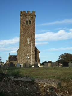
The earliest-known reference to Walwyn's Castle Church was 1291. The church was rebuilt around 1869 to 1878. Today the Church is in good repair with services held there every Sunday.[4]
School[]
The village school closed in the late 1950s, converted to a village hall, and substantially renovated in 2004.[4]
See also[]
References[]
- ^ Gwalchmai Bangor University Placenames Unit (Canolfan Bedwyr); accessed 9 May 2014
- ^ Google Maps (Map). Google.
- ^ "Custom report - Nomis - Official Labour Market Statistics". www.nomisweb.co.uk.
- ^ a b c d "Pembrokeshire Town and Community Councils: Walwyns Castle". Retrieved 27 March 2020.
- ^ Welsh Government website; 2011 Census Returns and stats; accessed 9 May 2014
- ^ Gesta Regum, William Stubbs, 1889, vol. 2, p. 89
- ^ a b "GENUKI: Walwyn's Castle". Retrieved 9 March 2016.
- ^ "Dyfed Archaeology: Hoaten to Hasguard". Retrieved 25 March 2020.
- ^ "GENUKI Parish Map 162". Retrieved 27 March 2020.
External links[]
 Media related to Walwyn's Castle at Wikimedia Commons

- Villages in Pembrokeshire
- Communities in Pembrokeshire