Ward Creek (Lake Tahoe)
| Ward Creek | |
|---|---|
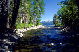 The mouth of Ward Creek on Lake Tahoe | |
 Location of the mouth of Ward Creek in California | |
| Native name | dagásliʔ [3] Error {{native name checker}}: parameter value is malformed (help) |
| Location | |
| Country | United States |
| State | California |
| Region | Placer County |
| Cities | , |
| Physical characteristics | |
| Source | Between Ward Peak and Twin Peaks[4] in the Granite Chief Wilderness of the Sierra Nevada Mountains |
| • coordinates | 39°07′10″N 120°14′20″W / 39.11944°N 120.23889°W[2] |
| • elevation | 7,940 ft (2,420 m)[5] |
| Mouth | Lake Tahoe |
• location | Tahoe Pines |
• coordinates | 39°07′45″N 120°09′18″W / 39.12917°N 120.15500°WCoordinates: 39°07′45″N 120°09′18″W / 39.12917°N 120.15500°W[2] |
• elevation | 6,234 ft (1,900 m)[2] |


Ward Creek is a 6.1-mile (9.8 km) eastward-flowing stream in Placer County, California, United States.[5] The creek flows into Lake Tahoe 2.7 miles (4.3 km) south of Tahoe City, California, and has undergone extensive restoration to reduce sediment and surface run-off to maintain the purity of Lake Tahoe.
History[]
Ward Creek and Ward Peak[6] are named for homesteader Ward Rush, whose claim was made on April 1, 1874.[1] In the early 1980s the McClatchy family donated lands on the south side of the creek to California State Parks.[7]
Watershed[]
Ward Creek, the fourth largest stream (by area and discharge) of the 63 Tahoe Basin watersheds contributes 6% of the stream runoff flowing into Lake Tahoe. The creek was a major source of sediment related to erosion from subdivisions and logging roads in the watershed.[8] The Ward Creek watershed drains an area of 6,200 acres (2,500 ha) and has a North Fork beginning on the south slope of Ward Peak and a South Fork originating on the north side of Twin Peaks. The Ward Creek watershed is just north of the Blackwood Creek watershed, and just south of Alpine Meadows Ski Resort which is on the north side of Ward Peak and Scott Peak. The creek mainstem is paralleled by Ward Creek Boulevard/Road.
Ecology[]
From 2006 to 2013 Ward Creek Park was restored by California State Parks, the California Tahoe Conservancy and other partners to reduce erosion which deposites sediment in Lake Tahoe, removal of fire-prone crowded trees and removal of a diversion dam.[9]
Beaver dams on Ward Creek reduce sediment and nutrient (such as phosphorus) loads that would otherwise flow to Lake Tahoe.[10] Recent evidence has shown that beaver (Castor canadensis) are native to the Sierra Nevada.[11][12] Their dams do not appear to pose barriers to trout passage.[13]
Recreation[]
Ward Creek Park is a California State Park whose 180 acres (73 ha) is bordered by Ward Creek on the north and Highway 89 on the east.[9] The area along the creek is protected by the California State Parks system. The Park has an extensive trail system that ties in with the bike path along Highway 89 and connects with USFS trails to Stanford Rock (which lies midway between Twin Peaks and the mouth of Ward Creek) and the Tahoe Rim Trail.
See also[]
References[]
- ^ a b Barbara Lekisch (1988). Tahoe Place Names: the Origin and History of Names in the Lake Tahoe Basin. Lafayette, California: Great West Books. p. 147. ISBN 9780944220016. Retrieved 2014-06-28.
- ^ a b c d U.S. Geological Survey Geographic Names Information System: Ward Creek
- ^ "The Washo Project Online Dictionary". Retrieved 2012-05-27.
- ^ U.S. Geological Survey Geographic Names Information System: Twin Peaks
- ^ a b U.S. Geological Survey. National Hydrography Dataset high-resolution flowline data. The National Map, accessed July 16, 2013
- ^ U.S. Geological Survey Geographic Names Information System: Ward Peak
- ^ Kathryn Reed (2013-09-17). "Restoration brings out charm of Ward Creek Park". Lake Tahoe News. Retrieved 2014-06-28.
- ^ Robert L. Leonard, Louis A. Kaplan, John F. Elder, Robert N. Coats and Charles R. Goldman (September 1979). "Nutrient Transport in Surface Runoff from a Subalpine Watershed, Lake Tahoe Basin, California". Ecological Monographs. 49 (3): 281–310. doi:10.2307/1942486. JSTOR 1942486.CS1 maint: uses authors parameter (link)
- ^ a b California State Parks Completes Major Environmental Renovation of Ward Creek Unit (PDF) (Report). California State Parks. 2013-04-24. Retrieved 2014-06-28.
- ^ Muskopf, Sarah (October 2007). The Effect of Beaver (Castor canadensis) Dam Removal on Total Phosphorus Concentration in Taylor Creek and Wetland, South Lake Tahoe, California (Thesis). Humboldt State University, Natural Resources. p. 23. hdl:2148/264.
- ^ James, C. D., Lanman, R. B. (Spring 2012). "Novel physical evidence that beaver historically were native to the Sierra Nevada". California Fish and Game. 98 (2): 129–132. Retrieved 2014-06-17.CS1 maint: uses authors parameter (link)
- ^ R. B. Lanman, H. Perryman, B. Dolman, Charles D. James (Spring 2012). "The historical range of beaver in the Sierra Nevada: a review of the evidence". California Fish and Game. 98 (2): 65–80. Retrieved 2014-06-17.CS1 maint: uses authors parameter (link)
- ^ Ryan L. Lokteff, Brett B. Roper, Joseph M. Wheaton (2013). "Do Beaver Dams Impede the Movement of Trout?" (PDF). Transactions of the American Fisheries Society. 142 (4): 1114–1125. doi:10.1080/00028487.2013.797497. Retrieved 2014-06-28.CS1 maint: uses authors parameter (link)
External links[]
- Rivers of Placer County, California
- Lake Tahoe
- Protected areas of Placer County, California
- State parks of California
- Rivers of Northern California
- Rivers of the Great Basin