Wardpark
Wardpark is an industrial estate in Cumbernauld, Scotland split by the M80 motorway.[1] The former Burroughs factory, the first factory of Cumbernauld new town, was reoccupied by OKI but was demolished to make way for Westway Retail Park, OKI having been relocated to Westfield.[2]
Warkpark is divided into three areas: Wardpark South, on the Abronhill side of the M80; Wardpark North on the Westerwood side; and Wardpark East which next to it and adjacent to Castlecary village. On the aerial photo the yellow building is part of the Wardpark Studios where the Outlander TV series is made. It is just north of the Westway Retail Park. This film company have plans to expand in 2018.[3]
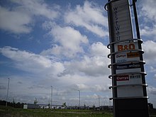
John G Russell Transport Limited bought one of the largest warehouses, at 5 Wardpark, early in 2018.[4] Other businesses in Wardpark North include Teledyne Technologies,[5] Aspen Solutions Ltd[6] Corporate Insignia Limited,[7] Thermaflow Ltd,[8] Coilcraft Europe Limited,[9] and Masonry Solutions Ltd.[10]
Wardpark South accommodates: Markon Limited,[11] Moulded Foams (Scotland) Ltd.,[12] Northwest Plant Limited[13]
Wardpark East accommodates: Coronet Services Limited,[14] Polyglass (GB) Limited,[15]
Cumbernauld Airport is at the northern edge of Wardpark with views down the Strathkelvin valley. The country road to the north has been blocked to motor vehicles and crosses the Antonine Wall and the main Glasgow-Edinburgh railway line before leading to the Forth and Clyde canal.


References[]
- ^ "Wardpark Cumbernauld". Wardpark Cumbernauld. ColeAD. Retrieved 15 February 2018.
- ^ Osborn, Frederic James; Whittick, Arnold (1963). The New towns - The Answer to Megalopolis. London: McGraw-Hill. pp. 312–321. Retrieved 25 October 2017.
- ^ Miller, Phil (9 February 2018). "Analysis:Three projects in the pipeline to help productions make big picture". Herald Scotland. Retrieved 15 February 2018.
- ^ "Colliers International makes flying start to 2018 with large warehouse sale". Scottish Business News Network. 1 February 2018. Retrieved 15 February 2018.
- ^ "Endole Suite G67 3EN". Retrieved 15 February 2018.
- ^ "Endole Suite G68 0EH". Retrieved 15 February 2018.
- ^ "Endole Suite G68 0HH". Retrieved 15 February 2018.
- ^ "Endole Suite G68 0LG". Retrieved 15 February 2018.
- ^ "Endole Suite G68 0LL". Retrieved 15 February 2018.
- ^ "Still a family affair for Wardpark firm". Cumbernauld News. 9 July 2018. Retrieved 9 July 2018.
- ^ "Endole Suite G68 0EF". Retrieved 15 February 2018.
- ^ "Endole Suite G67 3JZ". Retrieved 15 February 2018.
- ^ "Endole Suite G67 3EH". Retrieved 15 February 2018.
- ^ "Endole Suite G68 0LN". Retrieved 15 February 2018.
- ^ "Endole Suite G68 0LN". Retrieved 15 February 2018.
- ^ "OS 25 inch map 1892-1949, with Bing opacity slider". National Library of Scotland. Ordnance Survey. Retrieved 12 October 2017.

- Areas of Cumbernauld
- Business parks of Scotland
- Industrial parks in the United Kingdom
- Economy of North Lanarkshire