Weʽa
Weʽa
وع Weeca Oueah | |
|---|---|
Town | |
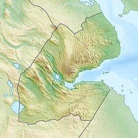 Weʽa Location in Djibouti | |
| Coordinates: 11°30′06″N 42°51′37″E / 11.50167°N 42.86028°ECoordinates: 11°30′06″N 42°51′37″E / 11.50167°N 42.86028°E | |
| Country | |
| Region | Arta |
| Elevation | 1,493 ft (455 m) |
| Population | |
| • Total | 4,667 |
| Time zone | UTC+3 (EAT) |
| Climate | BSh |

Weʽa or Wêʽa (Arabic: وع, Somali: Weeca) is a town in the Arta Region of Djibouti. It is located on the RN-1 National Highway, which connects it to Djibouti City, located some 37 kilometres (23 miles) to the east.[1][2] Weʽa is the second largest city in the Arta Region after Arta and before Damerjog. It is the primary transportation hub in western Djibouti via highway. The town is situated in a small valley.
History[]
Weʽa's place-name literally means "turn" in the Afro-Asiatic Somali language. It later formed a part of the French Somaliland protectorate in the first half of the 20th century.
Overview[]
Weʽa lies on the RN-1 National Highway.
Nearby towns and villages include Djibouti City, Arta and Holhol. Public buses go from Djibouti City to Weʽa, taking about half an hour to get to the town. The ride itself costs around 350 Djiboutian franc. Arta is situated just up the mountain around 3 kilometres (2 miles) to the north.
Additionally, Weʽa serves as a commercial transit point for goods from Ethiopia. Ethiopian trucks and traders frequently pass through the town.
Demographics[]
As of 2019, the population of Weʽa has been estimated to be 4,667. The town inhabitants belong to various mainly Afro-Asiatic-speaking ethnic groups, with the Issa Somali predominant.
Geography[]
The hills form a valley, which constitutes an extension of a wadi. Weʽa sits at an altitude of 455 metres (1,493 feet) above sea level in low-shrouded mountains and hills. The outskirts of the town have served as a local agricultural center.
Climate[]
Weʽa has a Semi-arid climate (BSh) in Köppen-Geiger system. The weather is hot during summer and very warm during winter. The warmest month of the year is June with an average temperature of 33.9 °C (93.0 °F). In January, the average temperature is 21.8 °C (71.2 °F). It is the lowest average temperature of the whole year and the driest month is June with 3 mm (0.1 in). Most precipitation falls in November, with an average of 42 mm (1.7 in).[3]
| hideClimate data for Weʽa | |||||||||||||
|---|---|---|---|---|---|---|---|---|---|---|---|---|---|
| Month | Jan | Feb | Mar | Apr | May | Jun | Jul | Aug | Sep | Oct | Nov | Dec | Year |
| Average high °C (°F) | 26.4 (79.5) |
26.8 (80.2) |
27.3 (81.1) |
28.4 (83.2) |
31.3 (88.4) |
35.7 (96.3) |
38.4 (101.1) |
37.8 (100.0) |
33.9 (93.0) |
29.8 (85.6) |
27.4 (81.4) |
26.6 (79.9) |
30.8 (87.5) |
| Average low °C (°F) | 16.8 (62.3) |
18.8 (65.9) |
19.9 (67.8) |
21.5 (70.7) |
23.7 (74.6) |
25.6 (78.1) |
27.8 (82.0) |
27.2 (81.0) |
23.9 (75.0) |
20.1 (68.1) |
18.7 (65.6) |
17.2 (63.0) |
21.8 (71.2) |
| Average rainfall mm (inches) | 28 (1.1) |
21 (0.8) |
22 (0.9) |
29 (1.1) |
6 (0.2) |
3 (0.1) |
6 (0.2) |
16 (0.6) |
9 (0.4) |
7 (0.3) |
42 (1.7) |
11 (0.4) |
200 (7.8) |
| Source 1: Climate-Data.org, altitude: 455m[3] | |||||||||||||
| Source 2: Levoyageur[4] | |||||||||||||
Sister towns[]
| Country | Town |
|---|---|
Notes[]
- ^ Google Maps (Map). Google.
|access-date=requires|url=(help) - ^ Bing Maps (Map). Microsoft and Harris Corporation Earthstar Geographics LLC.
|access-date=requires|url=(help) - ^ Jump up to: a b "Climate: We'a – Climate graph, Temperature graph, Climate table". Climate-Data.org. Retrieved 25 September 2013.
- ^ "DJIBOUTI - We'a : Climate, weather, temperatures". Levoyageur. Retrieved 25 September 2016.
References[]
External links[]
- Arta Region
- Populated places in Djibouti